Approximate Location Map
Large Map »
Latitude: 50.8825 / 50°52'57"N
Longitude: -0.3065 / 0°18'23"W
OS Eastings: 519230
OS Northings: 110593
OS Grid: TQ192105
Mapcode National: GBR HLT.M9X
Mapcode Global: FRA B67R.Y5Z
Plus Code: 9C2XVMMV+2C
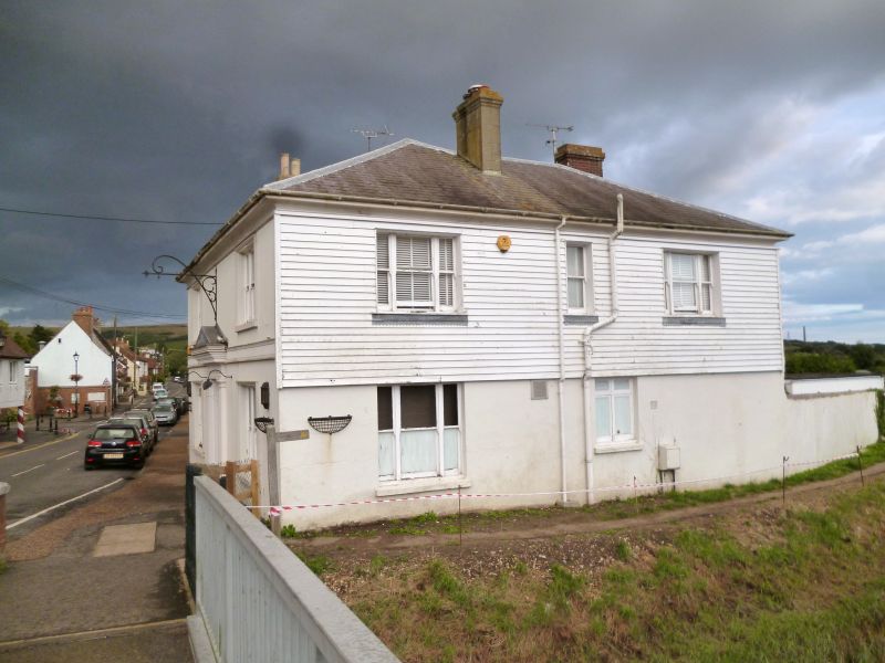
Entry Name: The Bridge Inn
Listing Date: 9 May 1980
Grade: II
Source: Historic England
Source ID: 1027223
English Heritage Legacy ID: 298899
ID on this website: 101027223
Location: Upper Beeding, Horsham, West Sussex, BN44
County: West Sussex
District: Horsham
Civil Parish: Upper Beeding
Built-Up Area: Upper Beeding
Traditional County: Sussex
Lieutenancy Area (Ceremonial County): West Sussex
Church of England Parish: Beeding St Peter and Bramber St Nicholas
Church of England Diocese: Chichester
Tagged with: Inn
1.
5404
TQ 1910
25/20
UPPER BEEDING
HIGH STREET
(south side)
The Bridge Inn
II
2.
Early-mid C19. Two storeys. Two windows facing the street, three windows
facing the river. Stuccoed. Stringcourse. Coved eaves cornice. Hipped slate
roof. Glazing bars missing. Doorway with pilasters, and projecting cornice.
Listing NGR: TQ1923010593
External links are from the relevant listing authority and, where applicable, Wikidata. Wikidata IDs may be related buildings as well as this specific building. If you want to add or update a link, you will need to do so by editing the Wikidata entry.


Other nearby listed buildings
