Approximate Location Map
Large Map »
Latitude: 50.8995 / 50°53'58"N
Longitude: -0.3584 / 0°21'30"W
OS Eastings: 515538
OS Northings: 112393
OS Grid: TQ155123
Mapcode National: GBR HLK.D7D
Mapcode Global: FRA B64Q.N6N
Plus Code: 9C2XVJXR+QM
Entry Name: The Parish Church of St Mary
Listing Date: 15 March 1955
Grade: II*
Source: Historic England
Source ID: 1027150
English Heritage Legacy ID: 299025
ID on this website: 101027150
Location: St Mary's Church, Horsham, West Sussex, BN44
County: West Sussex
District: Horsham
Civil Parish: Wiston
Traditional County: Sussex
Lieutenancy Area (Ceremonial County): West Sussex
Church of England Parish: Wiston with Buncton
Church of England Diocese: Chichester
Tagged with: Church building
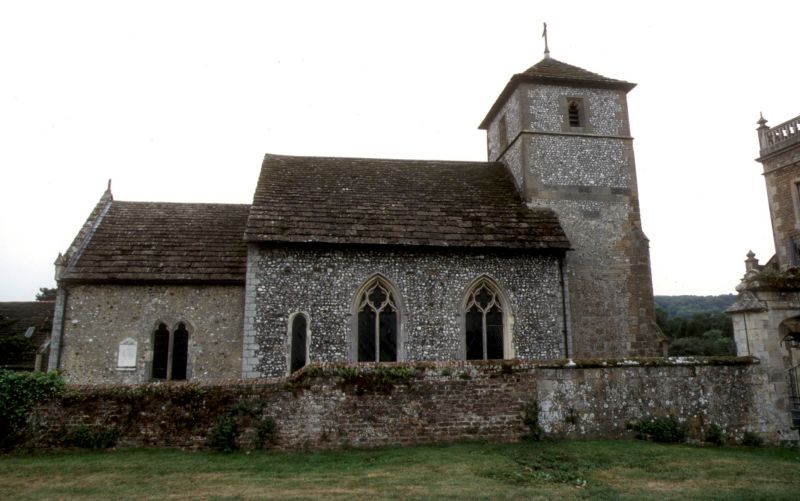
WISTON
1.
5404
The Parish Church of
St Mary
TQ 11 SE 13/338 15.3.55
II*
2.
Chancel, south chapel, twin naves and west tower.
Mainly C14, but much restored by G M Hills in 1862. South chapel contains
a brass of 1426 to Sir John de Braose and the tombs of the Shirley family who
owned Wiston House.
Listing NGR: TQ1553812393
External links are from the relevant listing authority and, where applicable, Wikidata. Wikidata IDs may be related buildings as well as this specific building. If you want to add or update a link, you will need to do so by editing the Wikidata entry.


Other nearby listed buildings
