Approximate Location Map
Large Map »
Latitude: 51.0228 / 51°1'22"N
Longitude: -0.4508 / 0°27'2"W
OS Eastings: 508751
OS Northings: 125965
OS Grid: TQ087259
Mapcode National: GBR GHK.T05
Mapcode Global: FRA 96YD.VLW
Plus Code: 9C3X2GFX+4M
Entry Name: High Bank
Listing Date: 28 November 1980
Grade: II
Source: Historic England
Source ID: 1192524
English Heritage Legacy ID: 299081
ID on this website: 101192524
Location: Billingshurst, Horsham, West Sussex, RH14
County: West Sussex
District: Horsham
Civil Parish: Billingshurst
Built-Up Area: Billingshurst
Traditional County: Sussex
Lieutenancy Area (Ceremonial County): West Sussex
Church of England Parish: Billingshurst St Mary
Church of England Diocese: Chichester
Tagged with: Architectural structure
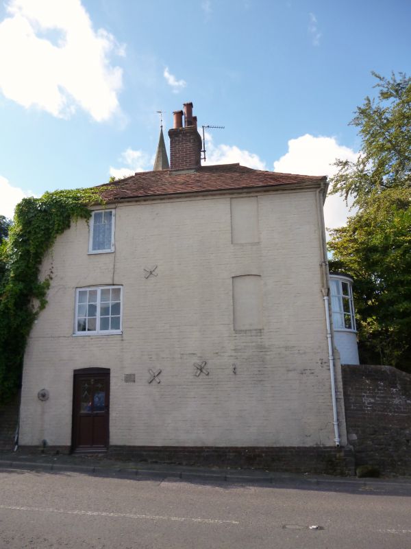
BILLINGSHURST EAST STREET
1.
5404
(south side)
No 2
(High Bank)
TQ 0825 25/369
II
2.
Early C19. Two storeys. Two windows. Painted brick. Hipped tiled roof.
Casement windows.
Listing NGR: TQ0874825964
External links are from the relevant listing authority and, where applicable, Wikidata. Wikidata IDs may be related buildings as well as this specific building. If you want to add or update a link, you will need to do so by editing the Wikidata entry.


Other nearby listed buildings
