Approximate Location Map
Large Map »
Latitude: 51.0238 / 51°1'25"N
Longitude: -0.451 / 0°27'3"W
OS Eastings: 508732
OS Northings: 126083
OS Grid: TQ087260
Mapcode National: GBR GHK.LT0
Mapcode Global: FRA 96YD.VGJ
Plus Code: 9C3X2GFX+GH
Entry Name: The King's Head Inn
Listing Date: 28 November 1980
Grade: II
Source: Historic England
Source ID: 1027136
English Heritage Legacy ID: 299102
ID on this website: 101027136
Location: Billingshurst, Horsham, West Sussex, RH14
County: West Sussex
District: Horsham
Civil Parish: Billingshurst
Built-Up Area: Billingshurst
Traditional County: Sussex
Lieutenancy Area (Ceremonial County): West Sussex
Church of England Parish: Billingshurst St Mary
Church of England Diocese: Chichester
Tagged with: Inn
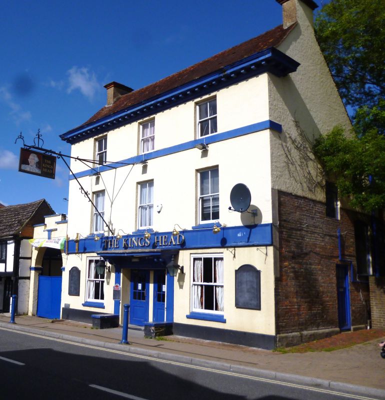
BILLINGSHURST HIGH STREET
1.
5404
(west side)
The King's Head Inn
TQ 0826 24/389
II
2.
Early Cl9. Three storeys. Two windows. Faced with rough plaster. Wide
eaves modillion cornice. Glazing bars missing. Two doorways with joint flat
hood on brackets. Round-headed corriage archway to yard on the south.
Listing NGR: TQ0873226083
External links are from the relevant listing authority and, where applicable, Wikidata. Wikidata IDs may be related buildings as well as this specific building. If you want to add or update a link, you will need to do so by editing the Wikidata entry.


Other nearby listed buildings
