Approximate Location Map
Large Map »
Latitude: 50.8358 / 50°50'9"N
Longitude: -0.8078 / 0°48'28"W
OS Eastings: 484049
OS Northings: 104712
OS Grid: SU840047
Mapcode National: GBR DGR.DMC
Mapcode Global: FRA 966W.M39
Plus Code: 9C2XR5PR+8V
Entry Name: The Bays
Listing Date: 5 July 1950
Grade: II
Source: Historic England
Source ID: 1192248
English Heritage Legacy ID: 299909
ID on this website: 101192248
Location: Fishbourne, Chichester, West Sussex, PO19
County: West Sussex
District: Chichester
Civil Parish: Fishbourne
Built-Up Area: Fishbourne
Traditional County: Sussex
Lieutenancy Area (Ceremonial County): West Sussex
Church of England Parish: Fishbourne St Peter and St Mary
Church of England Diocese: Chichester
Tagged with: Architectural structure
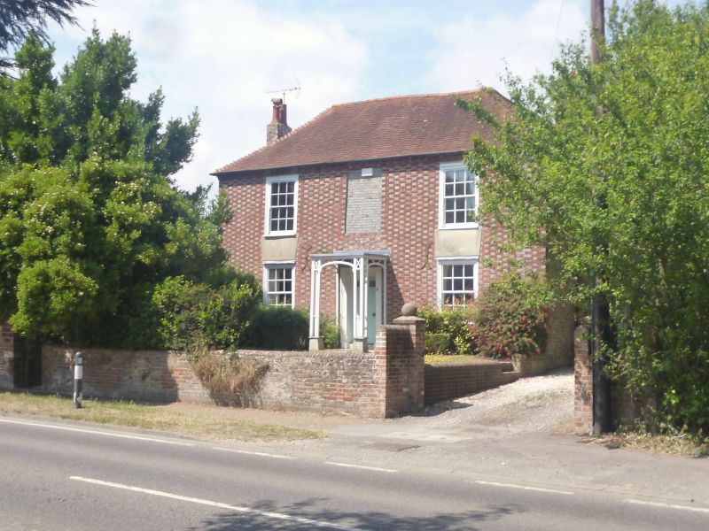
FISHBOURNE ROAD
1.
972
(North Side)
No 56 (The Bays)
SU 8404 16/397 5.7.50.
II
2.
C18. 2 storeys. 2 windows and 1 blocked. Red brick and grey headers
alternately. Small cornice with modillions below eaves. Sash windows in
frames with glazing bars intact. Trellised wooden porch. 6 panelled door
with top 2 panels cut away and glazed.
Listing NGR: SU8404904712
External links are from the relevant listing authority and, where applicable, Wikidata. Wikidata IDs may be related buildings as well as this specific building. If you want to add or update a link, you will need to do so by editing the Wikidata entry.


Other nearby listed buildings
