Approximate Location Map
Large Map »
Latitude: 50.8412 / 50°50'28"N
Longitude: -0.7787 / 0°46'43"W
OS Eastings: 486085
OS Northings: 105346
OS Grid: SU860053
Mapcode National: GBR DGS.1YJ
Mapcode Global: FRA 968W.0G2
Plus Code: 9C2XR6RC+FG
Entry Name: Wall to North of No 17
Listing Date: 8 October 1971
Grade: II
Source: Historic England
Source ID: 1354300
English Heritage Legacy ID: 299981
ID on this website: 101354300
Location: Chichester, West Sussex, PO19
County: West Sussex
District: Chichester
Civil Parish: Chichester
Built-Up Area: Chichester
Traditional County: Sussex
Lieutenancy Area (Ceremonial County): West Sussex
Church of England Parish: Chichester St Paul
Church of England Diocese: Chichester
Tagged with: Wall
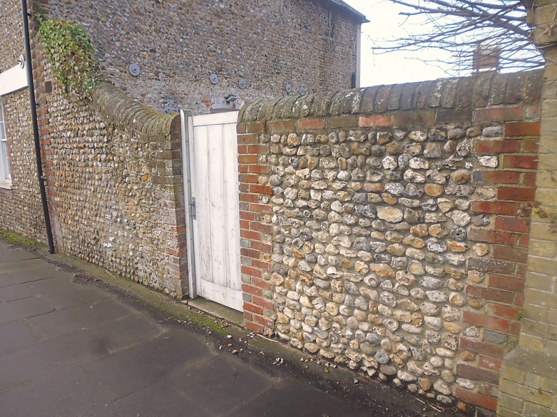
NORTHGATE
1.
972
Wall to North of No 17
SU 8605 SW 2/527A
II
2.
C19. About 10 feet high descending to about 5 feet. Flint cobbles with brick
quoins and brick coping.
Listing NGR: SU8608505346
External links are from the relevant listing authority and, where applicable, Wikidata. Wikidata IDs may be related buildings as well as this specific building. If you want to add or update a link, you will need to do so by editing the Wikidata entry.


Other nearby listed buildings
