Approximate Location Map
Large Map »
Latitude: 50.8405 / 50°50'25"N
Longitude: -0.7646 / 0°45'52"W
OS Eastings: 487082
OS Northings: 105282
OS Grid: SU870052
Mapcode National: GBR DGS.CHJ
Mapcode Global: FRA 968W.CXN
Plus Code: 9C2XR6RP+65
Entry Name: St James's Post
Listing Date: 8 October 1971
Grade: II
Source: Historic England
Source ID: 1354344
English Heritage Legacy ID: 300111
ID on this website: 101354344
Location: Portfield, Chichester, West Sussex, PO19
County: West Sussex
District: Chichester
Civil Parish: Chichester
Built-Up Area: Chichester
Traditional County: Sussex
Lieutenancy Area (Ceremonial County): West Sussex
Church of England Parish: Chichester St Pancras
Church of England Diocese: Chichester
Tagged with: Architectural structure
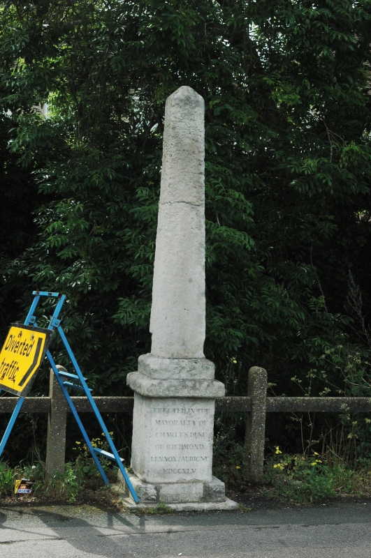
ST PANCRAS
1.
972
(Northwest Side)
St James's Post
SU 8705 14/364
II
2.
A stone obelisk in 1745 to mark the then North-East boundary of
the City. It also bears the date 1839.
Listing NGR: SU8708205282
External links are from the relevant listing authority and, where applicable, Wikidata. Wikidata IDs may be related buildings as well as this specific building. If you want to add or update a link, you will need to do so by editing the Wikidata entry.


Other nearby listed buildings
