Approximate Location Map
Large Map »
Latitude: 50.8421 / 50°50'31"N
Longitude: -0.7821 / 0°46'55"W
OS Eastings: 485849
OS Northings: 105433
OS Grid: SU858054
Mapcode National: GBR DGS.140
Mapcode Global: FRA 967W.54Y
Plus Code: 9C2XR6R9+R5
Entry Name: St Richard's Catholic Social Centre
Listing Date: 8 October 1971
Grade: II
Source: Historic England
Source ID: 1354351
English Heritage Legacy ID: 300137
ID on this website: 101354351
Location: Chichester, West Sussex, PO19
County: West Sussex
District: Chichester
Civil Parish: Chichester
Built-Up Area: Chichester
Traditional County: Sussex
Lieutenancy Area (Ceremonial County): West Sussex
Church of England Parish: Chichester St Paul
Church of England Diocese: Chichester
Tagged with: Architectural structure
ST PAUL'S ROAD
1.
972
(South-West Side)
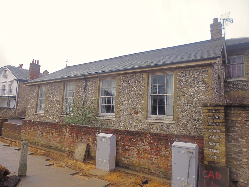
St Richard's Catholic
Social Centre
SU 8505 SE 1/555
II
2.
Formerly a school. Mid C19. 1 storey. 4 windows facing north-east.
Slate saddleback roof. Flint with yellow brick quoins and dressings.
Sash windows. 2 windows in south-east gable end.
Listing NGR: SU8584905433
External links are from the relevant listing authority and, where applicable, Wikidata. Wikidata IDs may be related buildings as well as this specific building. If you want to add or update a link, you will need to do so by editing the Wikidata entry.


Other nearby listed buildings
