Approximate Location Map
Large Map »
Latitude: 50.8329 / 50°49'58"N
Longitude: -0.78 / 0°46'47"W
OS Eastings: 486011
OS Northings: 104421
OS Grid: SU860044
Mapcode National: GBR DGS.MM9
Mapcode Global: FRA 967W.ZXL
Plus Code: 9C2XR6MC+52
Entry Name: 41, Southgate
Listing Date: 5 July 1950
Grade: II
Source: Historic England
Source ID: 1026646
English Heritage Legacy ID: 300155
ID on this website: 101026646
Location: The Close, Chichester, West Sussex, PO19
County: West Sussex
District: Chichester
Civil Parish: Chichester
Built-Up Area: Chichester
Traditional County: Sussex
Lieutenancy Area (Ceremonial County): West Sussex
Church of England Parish: Chichester St Paul
Church of England Diocese: Chichester
Tagged with: Building
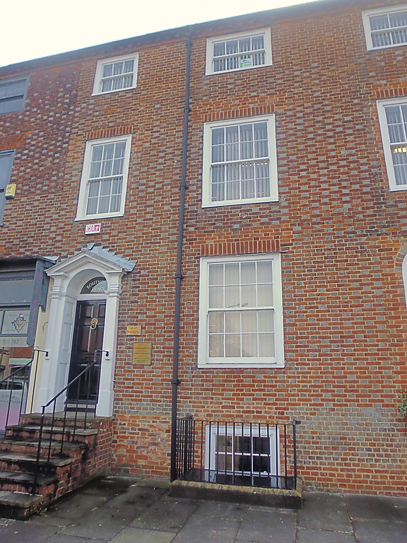
SOUTHGATE
1.
972
(East Side)
No 41
SU 8604 SW 19/301 5.7.50.
II GV
2.
Similar frontage to Nos 39 and 40 except no shop front and doorway up
4 steps. 6 panel moulded door in reveals; semi-circular fanlight.
Doorcase with Doric pilasters and rectangular pediment over.
Nos 36 to 42 (consec) form a group.
Listing NGR: SU8602004411
External links are from the relevant listing authority and, where applicable, Wikidata. Wikidata IDs may be related buildings as well as this specific building. If you want to add or update a link, you will need to do so by editing the Wikidata entry.


Other nearby listed buildings
