Approximate Location Map
Large Map »
Latitude: 50.8361 / 50°50'10"N
Longitude: -0.7791 / 0°46'44"W
OS Eastings: 486071
OS Northings: 104777
OS Grid: SU860047
Mapcode National: GBR DGS.FVY
Mapcode Global: FRA 968W.DBW
Plus Code: 9C2XR6PC+F9
Entry Name: 70 and 71, South Street
Listing Date: 8 October 1971
Grade: II
Source: Historic England
Source ID: 1026622
English Heritage Legacy ID: 300200
ID on this website: 101026622
Location: Chichester, West Sussex, PO19
County: West Sussex
District: Chichester
Civil Parish: Chichester
Built-Up Area: Chichester
Traditional County: Sussex
Lieutenancy Area (Ceremonial County): West Sussex
Church of England Parish: Chichester St Paul
Church of England Diocese: Chichester
Tagged with: Building
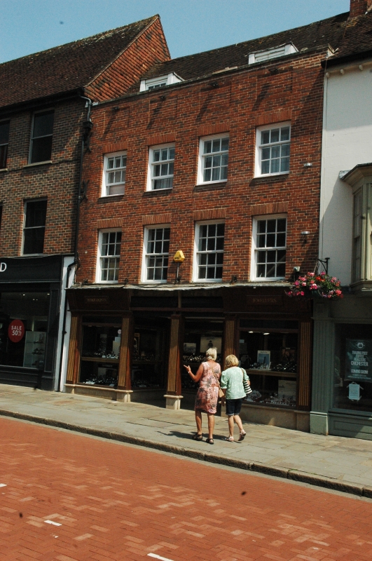
SOUTH STREET
1.
972
(East Side)
Nos 70 & 71
SU 8604 NW 4/84
II
2.
Front is modern, rebuilt using old materials (1947). Behind the front wall,
C17 timber-framed core. 3 storeys and cellar. 4 window bays. Old tiled
gabled roof with old stack behind; timber-framing exposed in front rooms
of 2nd storey.
Listing NGR: SU8608004774
External links are from the relevant listing authority and, where applicable, Wikidata. Wikidata IDs may be related buildings as well as this specific building. If you want to add or update a link, you will need to do so by editing the Wikidata entry.


Other nearby listed buildings
