Approximate Location Map
Large Map »
Latitude: 50.9111 / 50°54'39"N
Longitude: -0.5624 / 0°33'44"W
OS Eastings: 501166
OS Northings: 113385
OS Grid: TQ011133
Mapcode National: GBR FHF.W2Q
Mapcode Global: FRA 96QP.LQH
Plus Code: 9C2XWC6Q+C2
Entry Name: Leghorn Cottage
Listing Date: 22 May 1985
Grade: II
Source: Historic England
Source ID: 1354400
English Heritage Legacy ID: 300390
ID on this website: 101354400
Location: Bury, Chichester, West Sussex, RH20
County: West Sussex
District: Chichester
Civil Parish: Bury
Built-Up Area: Bury
Traditional County: Sussex
Lieutenancy Area (Ceremonial County): West Sussex
Church of England Parish: Bury St John the Evangelist with Houghton St Nicholas
Church of England Diocese: Chichester
Tagged with: Cottage
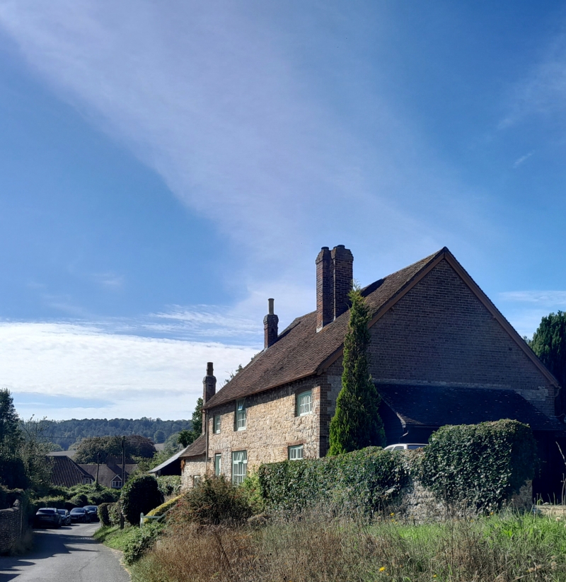
TQ 0113 BURY THE STREET
(west side)
26/27 Leghorn Cottage
II
Cottage. Early C19. Two storeys. Three windows. Malmstone rubble with red brick
dressings and quoins. Tiled roof. Casement windows.
Listing NGR: TQ0116613385
External links are from the relevant listing authority and, where applicable, Wikidata. Wikidata IDs may be related buildings as well as this specific building. If you want to add or update a link, you will need to do so by editing the Wikidata entry.


Other nearby listed buildings
