Approximate Location Map
Large Map »
Latitude: 50.8114 / 50°48'40"N
Longitude: -0.7764 / 0°46'35"W
OS Eastings: 486301
OS Northings: 102028
OS Grid: SU863020
Mapcode National: GBR DH5.2HM
Mapcode Global: FRA 968Y.FBJ
Plus Code: 9C2XR66F+HC
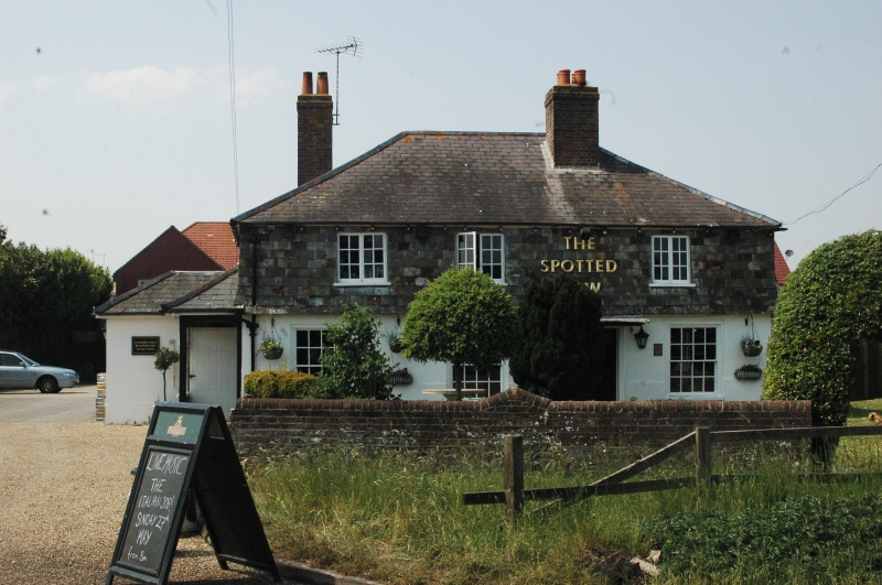
Entry Name: The Spotted Cow Public House
Listing Date: 28 January 1986
Grade: II
Source: Historic England
Source ID: 1026333
English Heritage Legacy ID: 300930
ID on this website: 101026333
Location: Hunston, Chichester, West Sussex, PO20
County: West Sussex
District: Chichester
Civil Parish: Hunston
Built-Up Area: Hunston
Traditional County: Sussex
Lieutenancy Area (Ceremonial County): West Sussex
Church of England Parish: Hunston St Leodegar
Church of England Diocese: Chichester
Tagged with: Pub
HUNSTON SELSEY ROAD
SU 80 SE
17/793 The Spotted Cow
- Public House
- II
Early C19. Two storeys. Three windows. Ground floor stuccoed above hung with
slates. Hipped slate roof. Sash windows with glazing bars on ground floor,
casement windows above. Doorway in moulded architraves surround with flat hood
over.
Listing NGR: SU8630102028
External links are from the relevant listing authority and, where applicable, Wikidata. Wikidata IDs may be related buildings as well as this specific building. If you want to add or update a link, you will need to do so by editing the Wikidata entry.


Other nearby listed buildings
