Approximate Location Map
Large Map »
Latitude: 50.8694 / 50°52'9"N
Longitude: -0.7771 / 0°46'37"W
OS Eastings: 486150
OS Northings: 108474
OS Grid: SU861084
Mapcode National: GBR DGD.GC4
Mapcode Global: FRA 968S.T8R
Plus Code: 9C2XV69F+P5
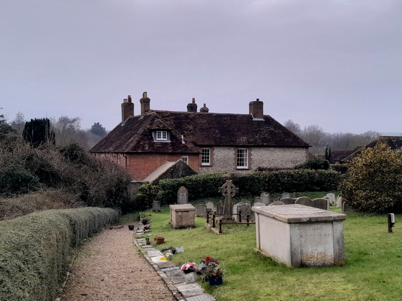
Entry Name: Manor Farmhouse
Listing Date: 28 January 1986
Grade: II
Source: Historic England
Source ID: 1354553
English Heritage Legacy ID: 300959
ID on this website: 101354553
Location: East Lavant, Chichester, West Sussex, PO18
County: West Sussex
District: Chichester
Civil Parish: Lavant
Traditional County: Sussex
Lieutenancy Area (Ceremonial County): West Sussex
Church of England Parish: Lavant St Mary
Church of England Diocese: Chichester
Tagged with: Farmhouse
LAVANT MAIN ROAD (north west side)
SU 8608-8708 EAST LAVANT
37/329 Manor Farmhouse
-
- II
L-shaped C18 house. Two storeys. Three windows facing south, two windows
facing east. Red brick. Tiled roof. Glazing bars intact. North east wing
flints with red brick dressings and quoins.
Listing NGR: SU8615208470
External links are from the relevant listing authority and, where applicable, Wikidata. Wikidata IDs may be related buildings as well as this specific building. If you want to add or update a link, you will need to do so by editing the Wikidata entry.


Other nearby listed buildings
