Approximate Location Map
Large Map »
Latitude: 50.8376 / 50°50'15"N
Longitude: -0.7222 / 0°43'19"W
OS Eastings: 490072
OS Northings: 105013
OS Grid: SU900050
Mapcode National: GBR DGV.J6N
Mapcode Global: FRA 96CW.JGL
Plus Code: 9C2XR7QH+34
Entry Name: Manor Farmhouse
Listing Date: 5 June 1958
Grade: II
Source: Historic England
Source ID: 1026289
English Heritage Legacy ID: 301024
ID on this website: 101026289
Location: Oving, Chichester, West Sussex, PO20
County: West Sussex
District: Chichester
Civil Parish: Oving
Traditional County: Sussex
Lieutenancy Area (Ceremonial County): West Sussex
Church of England Parish: Oving St Andrew
Church of England Diocese: Chichester
Tagged with: Farmhouse
OVING CHURCH LANE
SU 90 NW (West side)
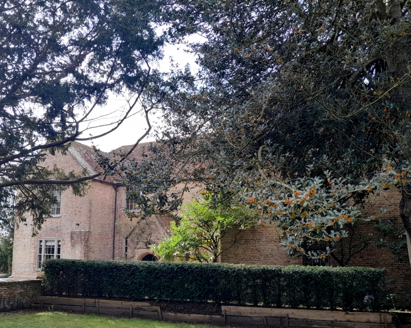
14/1 Manor Farmhouse
5.6.58
GV II
Late C17, incorporating part of an earlier house. Half H-plan. Two storeys.
Four windows. Red brick. Tiled roof. The projecting wings have gables. Sash
windows with glazing bars intact. C16 gabled porch with obtusely pointed arch
and dripstone over. Studded wooden door with moulded jambs.
Listing NGR: SU9007205013
External links are from the relevant listing authority and, where applicable, Wikidata. Wikidata IDs may be related buildings as well as this specific building. If you want to add or update a link, you will need to do so by editing the Wikidata entry.


Other nearby listed buildings
