Approximate Location Map
Large Map »
Latitude: 50.7347 / 50°44'5"N
Longitude: -0.7898 / 0°47'23"W
OS Eastings: 485496
OS Northings: 93488
OS Grid: SZ854934
Mapcode National: GBR DHX.YZ3
Mapcode Global: FRA 9774.G41
Plus Code: 9C2XP6M6+V3
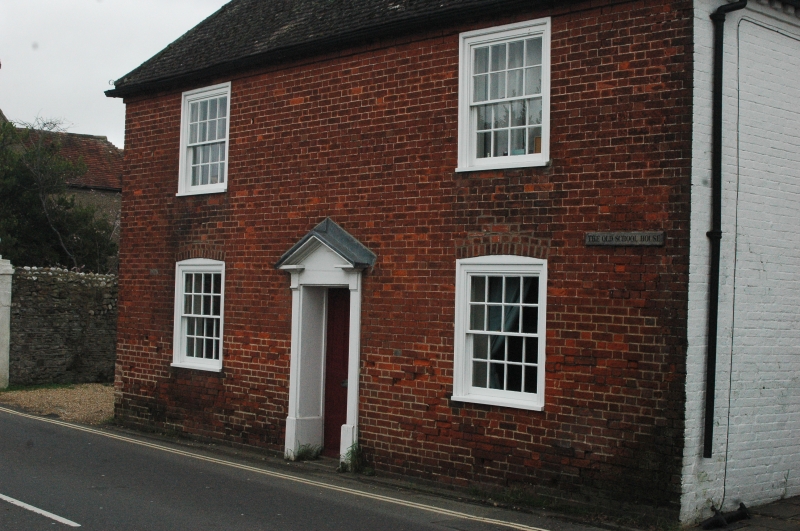
Entry Name: 43, High Street
Listing Date: 13 November 1969
Grade: II
Source: Historic England
Source ID: 1276743
English Heritage Legacy ID: 301095
ID on this website: 101276743
Location: Selsey, Chichester, West Sussex, PO20
County: West Sussex
District: Chichester
Civil Parish: Selsey
Built-Up Area: Selsey
Traditional County: Sussex
Lieutenancy Area (Ceremonial County): West Sussex
Church of England Parish: Selsey St Peter
Church of England Diocese: Chichester
Tagged with: Building
SZ 8493/8593
41/870
SELSEY
HIGH STREET
(East side)
No 43
II
Early C19. Two storeys. Two windows. Red brick. Modillion cornice. Hipped
tiled roof. Glazing bars intact. Doorway with pilasters and pediment.
Listing NGR: SZ8549693488
External links are from the relevant listing authority and, where applicable, Wikidata. Wikidata IDs may be related buildings as well as this specific building. If you want to add or update a link, you will need to do so by editing the Wikidata entry.


Other nearby listed buildings
