Approximate Location Map
Large Map »
Latitude: 50.784 / 50°47'2"N
Longitude: -0.7875 / 0°47'15"W
OS Eastings: 485569
OS Northings: 98967
OS Grid: SZ855989
Mapcode National: GBR DHB.RPW
Mapcode Global: FRA 9770.P0F
Plus Code: 9C2XQ6M6+HX
Entry Name: Church House
Listing Date: 28 January 1986
Grade: II
Source: Historic England
Source ID: 1233272
English Heritage Legacy ID: 301130
ID on this website: 101233272
Location: Street End, Chichester, West Sussex, PO20
County: West Sussex
District: Chichester
Civil Parish: Sidlesham
Built-Up Area: Street End
Traditional County: Sussex
Lieutenancy Area (Ceremonial County): West Sussex
Church of England Parish: Sidlesham
Church of England Diocese: Chichester
Tagged with: House
SIDLESHAM CHURCH FARM LANE
SZ 89 NE
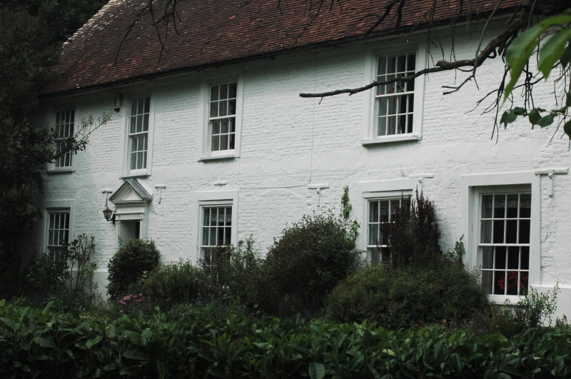
21/764 Church House.
-
- II
Late C18 or early C19. Two storeys. Four windows. Painted brick. Tiled
roof. Doorway with pilasters and pediment.
Listing NGR: SZ8557398966
External links are from the relevant listing authority and, where applicable, Wikidata. Wikidata IDs may be related buildings as well as this specific building. If you want to add or update a link, you will need to do so by editing the Wikidata entry.


Other nearby listed buildings
