Approximate Location Map
Large Map »
Latitude: 50.7841 / 50°47'2"N
Longitude: -0.7901 / 0°47'24"W
OS Eastings: 485391
OS Northings: 98974
OS Grid: SZ853989
Mapcode National: GBR DHB.R36
Mapcode Global: FRA 9770.N1G
Plus Code: 9C2XQ6M5+JX
Entry Name: St Mary's
Listing Date: 28 January 1986
Grade: II
Source: Historic England
Source ID: 1354591
English Heritage Legacy ID: 301177
ID on this website: 101354591
Location: Street End, Chichester, West Sussex, PO20
County: West Sussex
District: Chichester
Civil Parish: Sidlesham
Built-Up Area: Street End
Traditional County: Sussex
Lieutenancy Area (Ceremonial County): West Sussex
Church of England Parish: Sidlesham
Church of England Diocese: Chichester
Tagged with: Architectural structure Thatched building
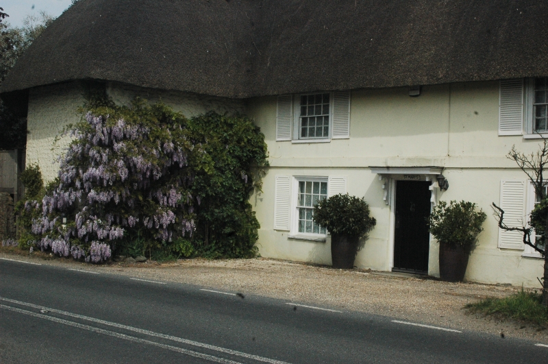
SIDLESHAM SELSEY ROAD
SZ 89 NE
21/747 St Mary's.
-
- II
L-shaped building. C18 or earlier. Two storeys. Two windows to south wing.
Painted brick. Hipped thatched roof. Casement windows. Doorway with flat
hood on brackets. Modern wing to north east making a T in all.
Listing NGR: SZ8539198974
External links are from the relevant listing authority and, where applicable, Wikidata. Wikidata IDs may be related buildings as well as this specific building. If you want to add or update a link, you will need to do so by editing the Wikidata entry.


Other nearby listed buildings
