Approximate Location Map
Large Map »
Latitude: 50.8499 / 50°50'59"N
Longitude: -0.7172 / 0°43'1"W
OS Eastings: 490402
OS Northings: 106378
OS Grid: SU904063
Mapcode National: GBR DGN.RGK
Mapcode Global: FRA 96DV.DFQ
Plus Code: 9C2XR7XM+W4
Entry Name: Amberley Danby
Listing Date: 28 January 1986
Grade: II
Source: Historic England
Source ID: 1234300
English Heritage Legacy ID: 301336
ID on this website: 101234300
Location: Tangmere, Chichester, West Sussex, PO20
County: West Sussex
District: Chichester
Civil Parish: Tangmere
Built-Up Area: Tangmere
Traditional County: Sussex
Lieutenancy Area (Ceremonial County): West Sussex
Church of England Parish: Tangmere St Andrew
Church of England Diocese: Chichester
Tagged with: Architectural structure
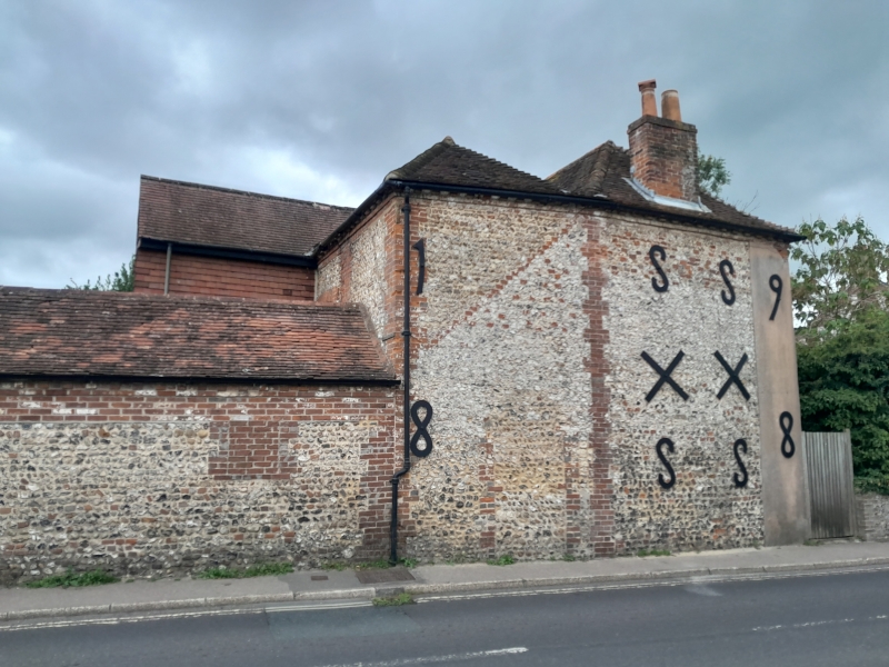
TANGMERE TANGMERE ROAD
SU 90 NW (east side)
14/31 Amberley & Danby
-
- II
One building. C18. Two storeys. Four windows. Amberley faced with flints
with red brick dressings and quoins, Danby wholly red brick. Modillion eaves
cornice. Tiled roof. Glazing bars intact on first floor only.
Listing NGR: SU9040206378
External links are from the relevant listing authority and, where applicable, Wikidata. Wikidata IDs may be related buildings as well as this specific building. If you want to add or update a link, you will need to do so by editing the Wikidata entry.


Other nearby listed buildings
