Approximate Location Map
Large Map »
Latitude: 50.8609 / 50°51'39"N
Longitude: -0.9273 / 0°55'38"W
OS Eastings: 475594
OS Northings: 107370
OS Grid: SU755073
Mapcode National: GBR CDW.SH5
Mapcode Global: FRA 86YT.NKR
Plus Code: 9C2XV36F+93
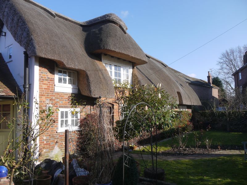
Entry Name: The Thatched Cottage
Listing Date: 28 January 1986
Grade: II
Source: Historic England
Source ID: 1234474
English Heritage Legacy ID: 301344
ID on this website: 101234474
Location: Westbourne, Chichester, West Sussex, PO10
County: West Sussex
District: Chichester
Civil Parish: Westbourne
Built-Up Area: Emsworth
Traditional County: Sussex
Lieutenancy Area (Ceremonial County): West Sussex
Church of England Parish: Westbourne St John the Baptist
Church of England Diocese: Chichester
Tagged with: Cottage Thatched cottage
WESTBOURNE CHURCH ROAD
SU 7407-7507
24/439 The Thatched Cottage
-
GV II
C17 or earlier timber framed building, refaced with red brick. Thatched roof
with two 'eyebrows'. Casement windows. One storey and attic. Three windows.
One dormer.
Listing NGR: SU7559407370
External links are from the relevant listing authority and, where applicable, Wikidata. Wikidata IDs may be related buildings as well as this specific building. If you want to add or update a link, you will need to do so by editing the Wikidata entry.


Other nearby listed buildings
