Approximate Location Map
Large Map »
Latitude: 50.8618 / 50°51'42"N
Longitude: -0.9257 / 0°55'32"W
OS Eastings: 475704
OS Northings: 107470
OS Grid: SU757074
Mapcode National: GBR CDW.SY1
Mapcode Global: FRA 86YT.H6D
Plus Code: 9C2XV36F+PP
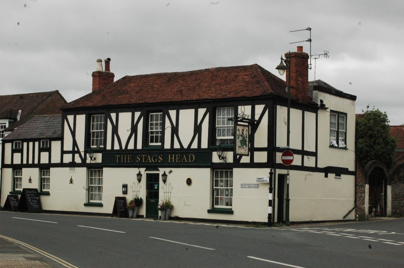
Entry Name: The Stag's Head Public House
Listing Date: 28 January 1986
Grade: II
Source: Historic England
Source ID: 1234691
English Heritage Legacy ID: 301392
ID on this website: 101234691
Location: Westbourne, Chichester, West Sussex, PO10
County: West Sussex
District: Chichester
Civil Parish: Westbourne
Built-Up Area: Emsworth
Traditional County: Sussex
Lieutenancy Area (Ceremonial County): West Sussex
Church of England Parish: Westbourne St John the Baptist
Church of England Diocese: Chichester
Tagged with: Pub
WESTBOURNE THE SQUARE
SU 7407-7507 (The Island site,
24/455 facing east)
- The Stag's Head Public House
- II
C18. Two storeys. Three windows. Stuccoed, the first floor decorated with
applied imitation timbering. Tiled roof. Glazing bars intact. Lower
section of two windows with slate roof to the south.
Listing NGR: SU7570407470
External links are from the relevant listing authority and, where applicable, Wikidata. Wikidata IDs may be related buildings as well as this specific building. If you want to add or update a link, you will need to do so by editing the Wikidata entry.


Other nearby listed buildings
