Approximate Location Map
Large Map »
Latitude: 50.7806 / 50°46'49"N
Longitude: -0.8984 / 0°53'54"W
OS Eastings: 477759
OS Northings: 98464
OS Grid: SZ777984
Mapcode National: GBR CFW.TZV
Mapcode Global: FRA 9700.V4Q
Plus Code: 9C2XQ4J2+6J
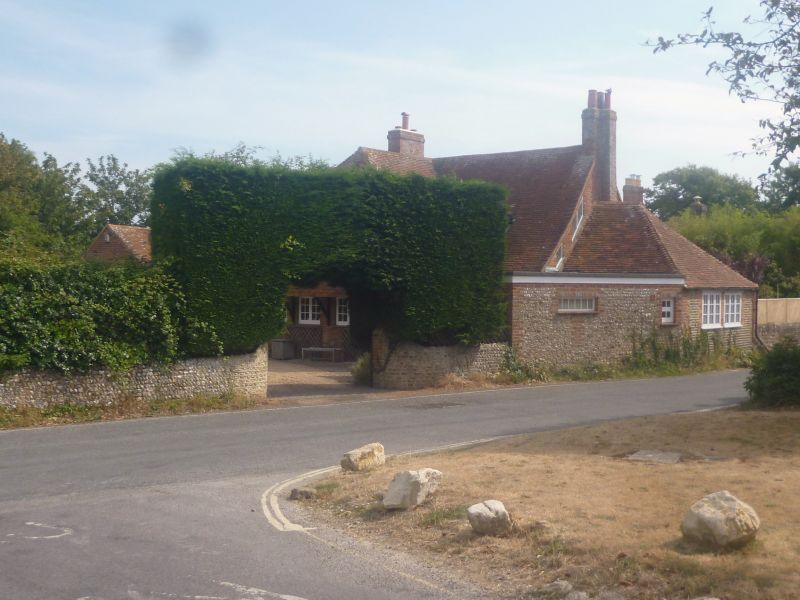
Entry Name: The Dog and Duck
Listing Date: 28 January 1986
Grade: II
Source: Historic England
Source ID: 1026075
English Heritage Legacy ID: 301515
ID on this website: 101026075
Location: West Wittering, Chichester, West Sussex, PO20
County: West Sussex
District: Chichester
Civil Parish: West Wittering
Built-Up Area: West Wittering
Traditional County: Sussex
Lieutenancy Area (Ceremonial County): West Sussex
Church of England Parish: West Wittering St Peter and St Paul
Church of England Diocese: Chichester
Tagged with: Building
SZ 79 NE
19/700
WEST WITTERING
POUND ROAD
The Dog & Duck
II
Formerly a public house. C18. Two storeys. Three windows. Stone rubble
with dressings, quoins and flush stringcourse of red brick. Tiled roof.
Casement windows.
Listing NGR: SZ7775998464
External links are from the relevant listing authority and, where applicable, Wikidata. Wikidata IDs may be related buildings as well as this specific building. If you want to add or update a link, you will need to do so by editing the Wikidata entry.


Other nearby listed buildings
