Approximate Location Map
Large Map »
Latitude: 50.9516 / 50°57'5"N
Longitude: -0.7502 / 0°45'0"W
OS Eastings: 487888
OS Northings: 117651
OS Grid: SU878176
Mapcode National: GBR DFG.94S
Mapcode Global: FRA 969L.KK3
Plus Code: 9C2XX62X+JW
Entry Name: The Old School
Listing Date: 26 November 1987
Grade: II
Source: Historic England
Source ID: 1026068
English Heritage Legacy ID: 301605
ID on this website: 101026068
Location: Cocking, Chichester, West Sussex, GU29
County: West Sussex
District: Chichester
Civil Parish: Cocking
Built-Up Area: Cocking
Traditional County: Sussex
Lieutenancy Area (Ceremonial County): West Sussex
Church of England Parish: Cocking with West Lavington
Church of England Diocese: Chichester
Tagged with: School building
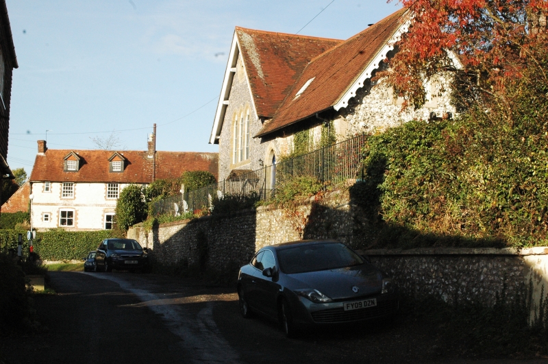
SU 8617-8717 COCKING MILL LANE
29/12 Nos 1-5 (consecutive)
The Old School
GV II
One building, originally the village school and the schoolmaster's house. T-shaped
mid C19 Gothic building. Faced with flints. Tiled roof. Casement windows. Pairs
of trefoil-headed lights on the ground floor. Gabled dormers above. Two storeys.
Four windows.
Listing NGR: SU8788417648
External links are from the relevant listing authority and, where applicable, Wikidata. Wikidata IDs may be related buildings as well as this specific building. If you want to add or update a link, you will need to do so by editing the Wikidata entry.


Other nearby listed buildings
