Approximate Location Map
Large Map »
Latitude: 50.9873 / 50°59'14"N
Longitude: -0.7322 / 0°43'55"W
OS Eastings: 489083
OS Northings: 121642
OS Grid: SU890216
Mapcode National: GBR DF3.1Q2
Mapcode Global: FRA 96CH.LL7
Plus Code: 9C2XX7P9+W4
Entry Name: Granary Adjoining the Ruins of Cowdray House on the South West
Listing Date: 18 June 1959
Grade: II
Source: Historic England
Source ID: 1232249
English Heritage Legacy ID: 301630
ID on this website: 101232249
Location: Midhurst, Chichester, West Sussex, GU29
County: West Sussex
District: Chichester
Civil Parish: Easebourne
Traditional County: Sussex
Lieutenancy Area (Ceremonial County): West Sussex
Church of England Parish: Easebourne St Mary
Church of England Diocese: Chichester
Tagged with: Granary
SU 82 SE EASEBOURNE EASEBOURNE LANE
11/59 Granary adjoining the Ruins
18.6.59 of Cowdray House on the south
west
II
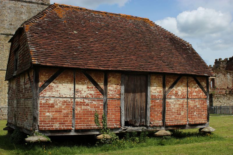
Granary. Small square C17 timber-framed building with red brick infilling. East
gable end tile-hung. Half hipped tiled roof. Stands on staddle stones.
Listing NGR: SU8908221642
External links are from the relevant listing authority and, where applicable, Wikidata. Wikidata IDs may be related buildings as well as this specific building. If you want to add or update a link, you will need to do so by editing the Wikidata entry.


Other nearby listed buildings
