Approximate Location Map
Large Map »
Latitude: 50.9702 / 50°58'12"N
Longitude: -0.8823 / 0°52'56"W
OS Eastings: 478572
OS Northings: 119572
OS Grid: SU785195
Mapcode National: GBR CCR.5QH
Mapcode Global: FRA 961K.22G
Plus Code: 9C2XX4C9+33
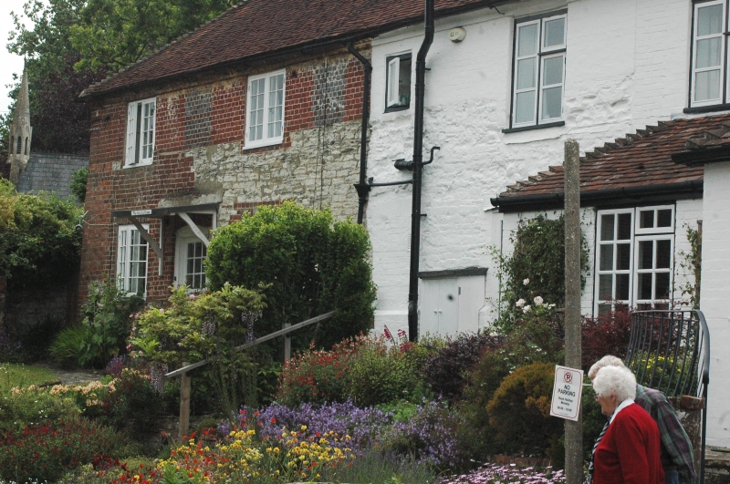
Entry Name: Laburnum Cottage
Listing Date: 10 September 1981
Grade: II
Source: Historic England
Source ID: 1233346
English Heritage Legacy ID: 301845
ID on this website: 101233346
Location: South Harting, Chichester, West Sussex, GU31
County: West Sussex
District: Chichester
Civil Parish: Harting
Built-Up Area: South Harting
Traditional County: Sussex
Lieutenancy Area (Ceremonial County): West Sussex
Church of England Parish: Harting St Mary and St Gabriel
Church of England Diocese: Chichester
Tagged with: Cottage
SU 7819-7919 HARTING THE SQUARE
28/33 Laburnum Cottage
10.9.81
- II
House. C17 timber-framed building, refaced in the C18. Ground floor now clunch
with red brick dressings and patched with red brick and grey headers. Tiled roof.
Casement windows. Two storeys. Two windows.
Listing NGR: SU7857219572
External links are from the relevant listing authority and, where applicable, Wikidata. Wikidata IDs may be related buildings as well as this specific building. If you want to add or update a link, you will need to do so by editing the Wikidata entry.


Other nearby listed buildings
