Approximate Location Map
Large Map »
Latitude: 50.9327 / 50°55'57"N
Longitude: -0.175 / 0°10'29"W
OS Eastings: 528343
OS Northings: 116387
OS Grid: TQ283163
Mapcode National: GBR JMQ.JKX
Mapcode Global: FRA B6JM.TZW
Plus Code: 9C2XWRMG+32
Entry Name: 131, High Street
Listing Date: 11 May 1983
Grade: II
Source: Historic England
Source ID: 1025636
English Heritage Legacy ID: 302629
ID on this website: 101025636
Location: Hurstpierpoint, Mid Sussex, BN6
County: West Sussex
District: Mid Sussex
Civil Parish: Hurstpierpoint and Sayers Common
Built-Up Area: Hurstpierpoint
Traditional County: Sussex
Lieutenancy Area (Ceremonial County): West Sussex
Church of England Parish: Hurstpierpoint
Church of England Diocese: Chichester
Tagged with: Building
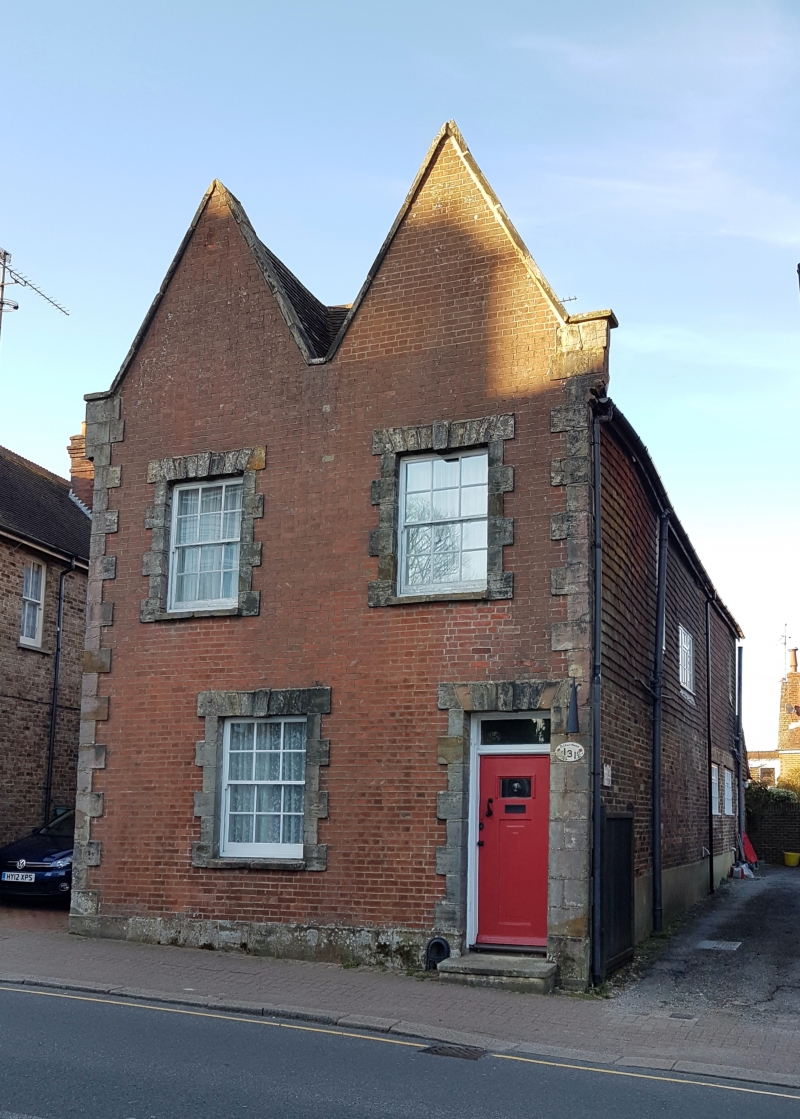
HURSTPIERPOINT HIGH STREET
1.
5405
(North Side)
No 131
TQ 2816 30/83
II
2.
Back part C18 and partly tile-hang. Front mid C19 and red brick. Two storeys.
Two windows. Long and short quoins and surrounds to windows and doorway.
Two narrow pointed gables. Casement windows.
Listing NGR: TQ2834316387
External links are from the relevant listing authority and, where applicable, Wikidata. Wikidata IDs may be related buildings as well as this specific building. If you want to add or update a link, you will need to do so by editing the Wikidata entry.


Other nearby listed buildings
