Approximate Location Map
Large Map »
Latitude: 51.0387 / 51°2'19"N
Longitude: -0.2077 / 0°12'27"W
OS Eastings: 525756
OS Northings: 128118
OS Grid: TQ257281
Mapcode National: GBR JLB.VQ3
Mapcode Global: FRA B6GC.LWY
Plus Code: 9C3X2QQR+FW
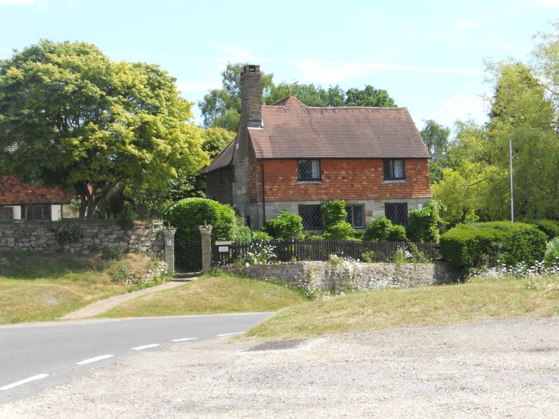
Entry Name: Rock Cottage
Listing Date: 11 May 1983
Grade: II
Source: Historic England
Source ID: 1181364
English Heritage Legacy ID: 302747
ID on this website: 101181364
Location: Slaugham, Mid Sussex, RH17
County: West Sussex
District: Mid Sussex
Civil Parish: Slaugham
Traditional County: Sussex
Lieutenancy Area (Ceremonial County): West Sussex
Church of England Parish: Slaugham St Mary
Church of England Diocese: Chichester
Tagged with: Cottage
SLAUGHAM THE GREEN
1.
5405
Slaugham
(East side)
Rock Cottage
TQ 2528 26/170
II
x2.
Small C17 or earlier timber-framed cottage, now fronted with ashlar on ground
floor and tile-hung above. Tiled roof. Casement windows. Two storeys.
Three windows.
Listing NGR: TQ2575628118
External links are from the relevant listing authority and, where applicable, Wikidata. Wikidata IDs may be related buildings as well as this specific building. If you want to add or update a link, you will need to do so by editing the Wikidata entry.


Other nearby listed buildings
