Approximate Location Map
Large Map »
Latitude: 52.1863 / 52°11'10"N
Longitude: -1.3537 / 1°21'13"W
OS Eastings: 444282
OS Northings: 254427
OS Grid: SP442544
Mapcode National: GBR 7R8.SPC
Mapcode Global: VHCVN.H96T
Plus Code: 9C4W5JPW+GG
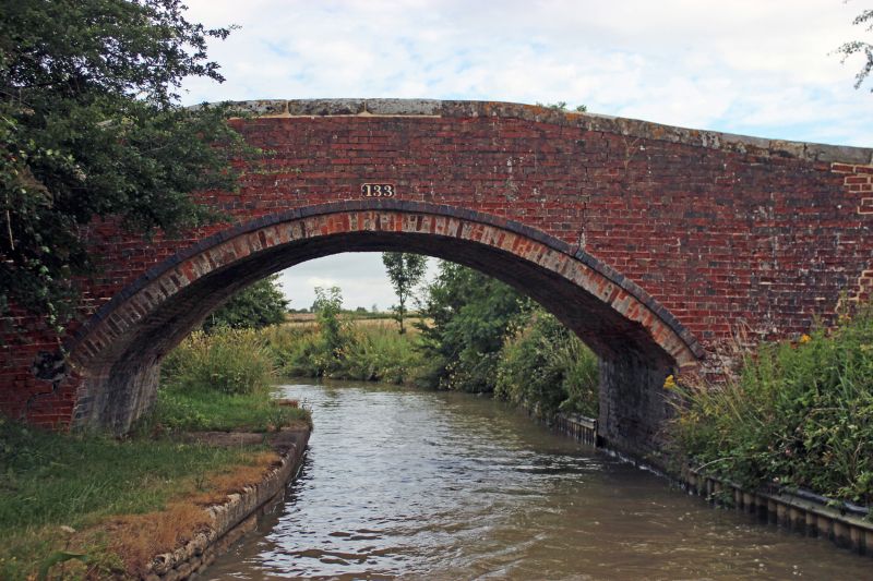
Entry Name: Oxford Canal Canal Bridge Number 133
Listing Date: 21 April 1986
Grade: II
Source: Historic England
Source ID: 1024405
English Heritage Legacy ID: 305759
ID on this website: 101024405
Location: Stratford-on-Avon, Warwickshire, CV47
County: Warwickshire
District: Stratford-on-Avon
Civil Parish: Wormleighton
Traditional County: Warwickshire
Lieutenancy Area (Ceremonial County): Warwickshire
Church of England Parish: Wormleighton St Peter
Church of England Diocese: Coventry
SP45SW WORMLEIGHTON OXFORD CANAL
7/183 Canal Bridge No 133
II
Canal bridge. Late C18/early C19. English bond red brick with some flared brick; parapet has stone flat coping. Hump-back. Segmental-arch has projecting course of flared brick.
Listing NGR: SP4428254427
External links are from the relevant listing authority and, where applicable, Wikidata. Wikidata IDs may be related buildings as well as this specific building. If you want to add or update a link, you will need to do so by editing the Wikidata entry.


Other nearby listed buildings
