Approximate Location Map
Large Map »
Latitude: 52.2826 / 52°16'57"N
Longitude: -1.5859 / 1°35'9"W
OS Eastings: 428348
OS Northings: 265022
OS Grid: SP283650
Mapcode National: GBR 5M4.V5P
Mapcode Global: VHBXH.GWGJ
Plus Code: 9C4W7CM7+2M
Entry Name: 19-25, the Butts
Listing Date: 19 March 1973
Grade: II
Source: Historic England
Source ID: 1364791
English Heritage Legacy ID: 307399
ID on this website: 101364791
Location: Warwick, Warwickshire, CV34
County: Warwickshire
District: Warwick
Civil Parish: Warwick
Built-Up Area: Warwick
Traditional County: Warwickshire
Lieutenancy Area (Ceremonial County): Warwickshire
Church of England Parish: Warwick St Mary
Church of England Diocese: Coventry
Tagged with: Building
1.
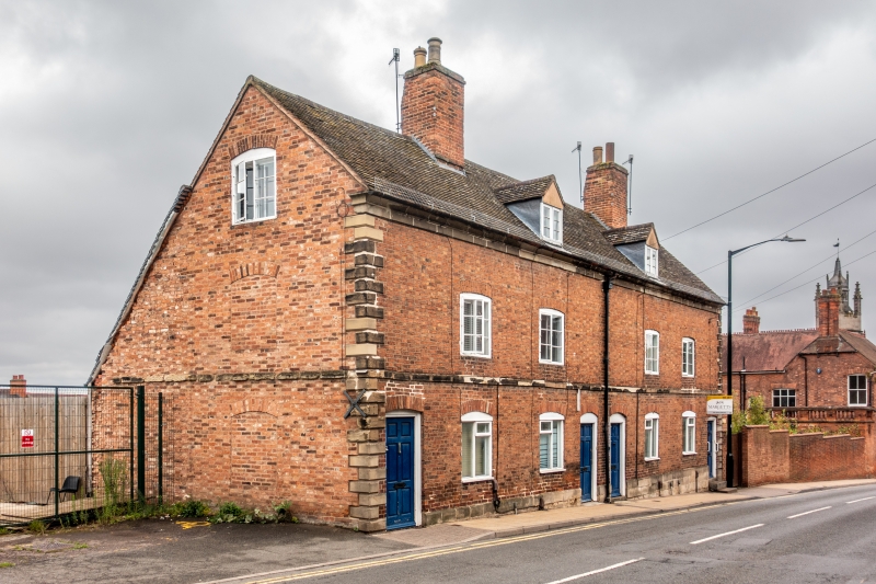
1781 THE BUTTS
(North East Side)
Nos 19 to 25 (odd)
SP 2865 SW 3/420
II GV
2.
1787. Red brick, stone facings, old tiled roof. Plinth, first floor band,
cavetto cornice chamfered quoins. 4 metal casements under cambered arches.
Nos 19 to 25 (odd), form a group.
Listing NGR: SP2834865021
External links are from the relevant listing authority and, where applicable, Wikidata. Wikidata IDs may be related buildings as well as this specific building. If you want to add or update a link, you will need to do so by editing the Wikidata entry.


Other nearby listed buildings
