Approximate Location Map
Large Map »
Latitude: 52.2807 / 52°16'50"N
Longitude: -1.5871 / 1°35'13"W
OS Eastings: 428266
OS Northings: 264807
OS Grid: SP282648
Mapcode National: GBR 5M4.TW0
Mapcode Global: VHBXH.FYT0
Plus Code: 9C4W7CJ7+75
Entry Name: 10, Castle Street
Listing Date: 10 January 1953
Grade: II
Source: Historic England
Source ID: 1184179
English Heritage Legacy ID: 307410
ID on this website: 101184179
Location: Warwick, Warwickshire, CV34
County: Warwickshire
District: Warwick
Civil Parish: Warwick
Built-Up Area: Warwick
Traditional County: Warwickshire
Lieutenancy Area (Ceremonial County): Warwickshire
Church of England Parish: Warwick St Mary
Church of England Diocese: Coventry
Tagged with: Building
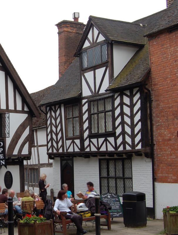
1.
1781 CASTLE STREET
(West Side)
No 10
SP 2864 NW 1/5 10.1.53.
II GV
2.
Circa 1500. 2 storeys plus attic timber-framed house. Jettied first
floor has enriched bressumer supported on projecting rafters. Late C16
wall painting found in southern part of building (VCH, viii, p,426). Machine
tiled roof.
Nos (10, 12, 16 and 20 form a group.
Listing NGR: SP2826664806
External links are from the relevant listing authority and, where applicable, Wikidata. Wikidata IDs may be related buildings as well as this specific building. If you want to add or update a link, you will need to do so by editing the Wikidata entry.


Other nearby listed buildings
