Approximate Location Map
Large Map »
Latitude: 52.2824 / 52°16'56"N
Longitude: -1.5841 / 1°35'2"W
OS Eastings: 428471
OS Northings: 265003
OS Grid: SP284650
Mapcode National: GBR 5M4.VQJ
Mapcode Global: VHBXH.HWFN
Plus Code: 9C4W7CJ8+X9
Entry Name: The Gables
Listing Date: 19 March 1973
Grade: II
Source: Historic England
Source ID: 1364821
English Heritage Legacy ID: 307454
ID on this website: 101364821
Location: Warwick, Warwickshire, CV34
County: Warwickshire
District: Warwick
Civil Parish: Warwick
Built-Up Area: Warwick
Traditional County: Warwickshire
Lieutenancy Area (Ceremonial County): Warwickshire
Church of England Parish: Warwick St Nicholas
Church of England Diocese: Coventry
Tagged with: Architectural structure
1.
1781 GERRARD STREET
(East Side)
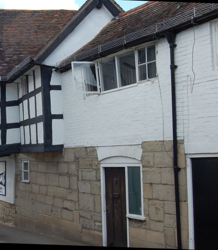
The Gables
SP 2864 NW 1/48
SP 2865 SW 3/48
II
2.
Probably C17 origin. 2 storey continuation to rear of No 16 Smith Street
(South Side). Lower storey of colour-washed stone blocks. Upper storey
of C18 brickwork; some original C18 leaded lights remain. Other windows
are modern. Old tiles.
Listing NGR: SP2847165003
External links are from the relevant listing authority and, where applicable, Wikidata. Wikidata IDs may be related buildings as well as this specific building. If you want to add or update a link, you will need to do so by editing the Wikidata entry.


Other nearby listed buildings
