Approximate Location Map
Large Map »
Latitude: 52.2824 / 52°16'56"N
Longitude: -1.5928 / 1°35'33"W
OS Eastings: 427877
OS Northings: 264995
OS Grid: SP278649
Mapcode National: GBR 5M4.S5R
Mapcode Global: VHBXH.BWTP
Plus Code: 9C4W7CJ4+XV
Entry Name: The Firs
Listing Date: 19 March 1973
Grade: II
Source: Historic England
Source ID: 1035383
English Heritage Legacy ID: 307660
ID on this website: 101035383
Location: Warwick, Warwickshire, CV34
County: Warwickshire
District: Warwick
Civil Parish: Warwick
Built-Up Area: Warwick
Traditional County: Warwickshire
Lieutenancy Area (Ceremonial County): Warwickshire
Church of England Parish: Warwick St Paul
Church of England Diocese: Coventry
Tagged with: Building
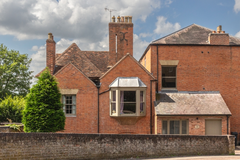
1.
1781 THEATRE STREET
(West Side)
The Firs
SP 2765 SE 5/249
SP 2764 8/249
II
2.
3 storey house of late C17 origin, but enlarged and the greater part of
exterior refaced circa 1872. Main item of interest consists of small 2
storey portion on south side, of C17 ashlar, which retains simple wood
cornice with plain modillions. Remainder of exterior is satisfactory.
VCH, viii, p.436.
Listing NGR: SP2787764995
External links are from the relevant listing authority and, where applicable, Wikidata. Wikidata IDs may be related buildings as well as this specific building. If you want to add or update a link, you will need to do so by editing the Wikidata entry.


Other nearby listed buildings
