Approximate Location Map
Large Map »
Latitude: 52.2782 / 52°16'41"N
Longitude: -1.592 / 1°35'31"W
OS Eastings: 427930
OS Northings: 264531
OS Grid: SP279645
Mapcode National: GBR 5MB.0BP
Mapcode Global: VHBXH.CZ6W
Plus Code: 9C4W7CH5+75
Entry Name: 57, West Street
Listing Date: 19 March 1973
Grade: II
Source: Historic England
Source ID: 1035355
English Heritage Legacy ID: 307682
ID on this website: 101035355
Location: Warwick, Warwickshire, CV34
County: Warwickshire
District: Warwick
Civil Parish: Warwick
Built-Up Area: Warwick
Traditional County: Warwickshire
Lieutenancy Area (Ceremonial County): Warwickshire
Church of England Parish: Warwick St Paul
Church of England Diocese: Coventry
Tagged with: Building
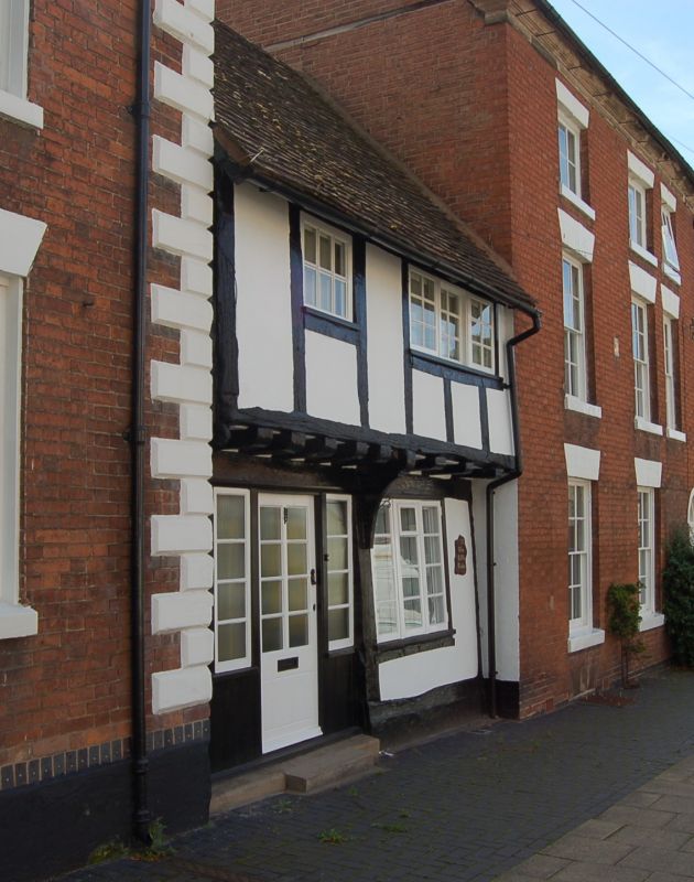
1.
1781 WEST STREET
(South East Side)
No 57
SP 2764 8/523
II GV
2.
C16 or early C17. Fairly heavy square timber framing, jettied at first
floor. Plaster infilling, tiled roof. 2 storeys, flush casements with
glazing bars.
Nos 49 to 63 (odd) form a group
Listing NGR: SP2793064530
External links are from the relevant listing authority and, where applicable, Wikidata. Wikidata IDs may be related buildings as well as this specific building. If you want to add or update a link, you will need to do so by editing the Wikidata entry.


Other nearby listed buildings
