Approximate Location Map
Large Map »
Latitude: 52.3552 / 52°21'18"N
Longitude: -1.5842 / 1°35'3"W
OS Eastings: 428412
OS Northings: 273099
OS Grid: SP284730
Mapcode National: GBR 5LC.89G
Mapcode Global: VHBX9.H2B9
Plus Code: 9C4W9C48+38
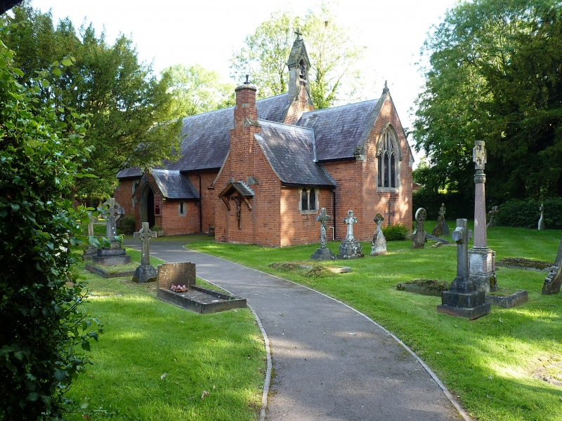
Entry Name: Roman Catholic Church of St Augustine
Listing Date: 1 June 1949
Grade: II
Source: Historic England
Source ID: 1035333
English Heritage Legacy ID: 307731
ID on this website: 101035333
Location: St Augustine's Roman Catholic Church, Ladyes Hills, Warwick, Warwickshire, CV8
County: Warwickshire
District: Warwick
Town: Warwick
Civil Parish: Kenilworth
Built-Up Area: Kenilworth
Traditional County: Warwickshire
Lieutenancy Area (Ceremonial County): Warwickshire
Church of England Parish: Kenilworth St Nicholas
Church of England Diocese: Coventry
Tagged with: Church building
BIRMINGHAM ROAD
1.
1270
CHURCH OF ST AUGUSTINE
Roman Catholic Church
SP 27 SE 1/49 1.6.49
II
2.
Circa 1840 by Augustus Welby Northmore Pugin. Red brick, stone dressings, decorated style. Nave, chancel, south porch and vestry, north aisle.
Listing NGR: SP2841273099
External links are from the relevant listing authority and, where applicable, Wikidata. Wikidata IDs may be related buildings as well as this specific building. If you want to add or update a link, you will need to do so by editing the Wikidata entry.


Other nearby listed buildings
