Approximate Location Map
Large Map »
Latitude: 52.351 / 52°21'3"N
Longitude: -1.5786 / 1°34'42"W
OS Eastings: 428799
OS Northings: 272634
OS Grid: SP287726
Mapcode National: GBR 5LC.HR0
Mapcode Global: VHBX9.L59J
Plus Code: 9C4W9C2C+CH
Entry Name: Royal Oak Inn
Listing Date: 10 November 1971
Grade: II
Source: Historic England
Source ID: 1364895
English Heritage Legacy ID: 307832
Also known as: Royal Oak, Kenilworth
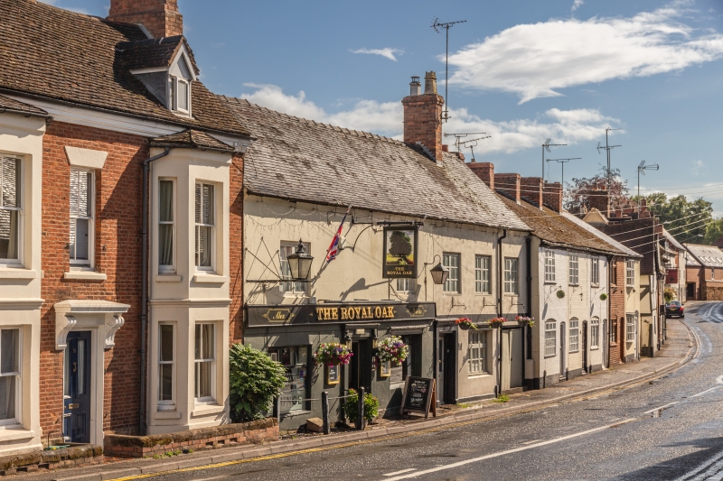
Royal Oak
ID on this website: 101364895
Location: Ladyes Hills, Warwick, Warwickshire, CV8
County: Warwickshire
District: Warwick
Civil Parish: Kenilworth
Built-Up Area: Kenilworth
Traditional County: Warwickshire
Lieutenancy Area (Ceremonial County): Warwickshire
Church of England Parish: Kenilworth St Nicholas
Church of England Diocese: Coventry
NEW STREET
1.
1270
(South Side)
Royal Oak Inn
SP 2872 NE 8/125
II
2.
C17 or C18, altered C19. Stucco, old tile roof, cavetto cornice. 2 storeys,
5 1st floor casements with glazing bars. C19 ground floor windows.
Listing NGR: SP2879972634
External links are from the relevant listing authority and, where applicable, Wikidata. Wikidata IDs may be related buildings as well as this specific building. If you want to add or update a link, you will need to do so by editing the Wikidata entry.


Other nearby listed buildings
