Approximate Location Map
Large Map »
Latitude: 52.4904 / 52°29'25"N
Longitude: -1.6611 / 1°39'39"W
OS Eastings: 423108
OS Northings: 288109
OS Grid: SP231881
Mapcode National: GBR 5JJ.T0D
Mapcode Global: VHBWH.5N6Q
Plus Code: 9C4WF8RQ+5H
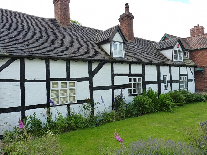
Entry Name: Cocksparrow Hall
Listing Date: 20 March 1979
Grade: II
Source: Historic England
Source ID: 1365131
English Heritage Legacy ID: 309021
ID on this website: 101365131
Location: North Warwickshire, B46
County: Warwickshire
District: North Warwickshire
Civil Parish: Maxstoke
Traditional County: Warwickshire
Lieutenancy Area (Ceremonial County): Warwickshire
Church of England Parish: Maxstoke
Church of England Diocese: Birmingham
Tagged with: House
MAXSTOKE COLESHILL ROAD
SP28NW (South side)
5/116 Cocksparrow Hall
20/03/79
- II
Cottage. Early C17. Timber-framed and brick infill, colourwashed. Plain-tiled
roof. 2 rebuilt red brick ridge stacks. 4 bays. 1 storey and attic. 2 C20 gable
dormers. 4 C20 ground floor wood casements. Centre bay has framing of height of
2 panels to the wall. The end bays have small framing. Entry in rear wall.
Listing NGR: SP2310888109
External links are from the relevant listing authority and, where applicable, Wikidata. Wikidata IDs may be related buildings as well as this specific building. If you want to add or update a link, you will need to do so by editing the Wikidata entry.


Other nearby listed buildings
