Approximate Location Map
Large Map »
Latitude: 52.5271 / 52°31'37"N
Longitude: -1.6687 / 1°40'7"W
OS Eastings: 422571
OS Northings: 292187
OS Grid: SP225921
Mapcode National: GBR 5J3.JXB
Mapcode Global: VHBW9.1R53
Plus Code: 9C4WG8GJ+RG
Entry Name: Betteridge Farmhouse
Listing Date: 26 January 1989
Grade: II
Source: Historic England
Source ID: 1186146
English Heritage Legacy ID: 309413
ID on this website: 101186146
Location: Hoggrill's End, North Warwickshire, B46
County: Warwickshire
District: North Warwickshire
Civil Parish: Nether Whitacre
Traditional County: Warwickshire
Lieutenancy Area (Ceremonial County): Warwickshire
Church of England Parish: Whitacres, Lea Marston and Shustoke
Church of England Diocese: Birmingham
Tagged with: Farmhouse
NETHER WHITACRE HOGGRILL'S END
SP29SW
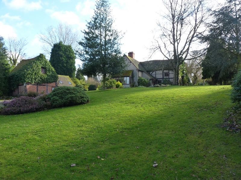
5/99 Betteridge Farmhouse
- II
Farmhouse, now house. C17 with later alterations and additions. Timber-framed
with roughcast infill panels and roughcast additions; plain tile roof; brick
ridge stack. 2-bay main range aligned east-west with extension wings to the
north-east and south-west. North front: 2 storeys. Irregular fenestration but
mainly C20 casements. Main range to the right with 2 tiers of small square
panels to the ground storey and 2 tiers of larger panels to the first floor,
with long curved braces. Gabled wing to the left with C20 lean-to bay window.
The roof of this wing catslides over a porch situated in the re-entrant angle
between wing and main range. The right hand gable of the main range has more
exposed wall framing and a collar-and-tie-beam roof truss with raking queen
struts. Interior: chamfered and stopped ceiling beams. At first floor level in
the partition wall between the 2 bays of the main house is a 2-light chamfer
mullioned window with small glass panes.
Listing NGR: SP2257192187
External links are from the relevant listing authority and, where applicable, Wikidata. Wikidata IDs may be related buildings as well as this specific building. If you want to add or update a link, you will need to do so by editing the Wikidata entry.


Other nearby listed buildings
