Approximate Location Map
Large Map »
Latitude: 50.7008 / 50°42'2"N
Longitude: -1.2924 / 1°17'32"W
OS Eastings: 450068
OS Northings: 89254
OS Grid: SZ500892
Mapcode National: GBR 8BB.XSC
Mapcode Global: FRA 8757.4BX
Plus Code: 9C2WPP25+82
Entry Name: 18, Quay Street
Listing Date: 1 February 1972
Grade: II
Source: Historic England
Source ID: 1034550
English Heritage Legacy ID: 309674
ID on this website: 101034550
Location: Newport, Isle of Wight, PO30
County: Isle of Wight
Civil Parish: Newport
Built-Up Area: Newport
Traditional County: Hampshire
Lieutenancy Area (Ceremonial County): Isle of Wight
Church of England Parish: Newport St Thomas
Church of England Diocese: Portsmouth
Tagged with: Building
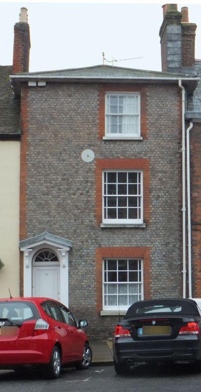
QUAY STREET
1.
1445
(South East Side)
No 18
SZ 5089 SW 3/73
II GV
2.
Early C19. 3 storeys. Purple brick with red brick dressings. One window.
Round headed door with simple fanlight and 2 moulded panels.
Nos 17 to 21 (consec) form a group
Listing NGR: SZ5007289252
External links are from the relevant listing authority and, where applicable, Wikidata. Wikidata IDs may be related buildings as well as this specific building. If you want to add or update a link, you will need to do so by editing the Wikidata entry.


Other nearby listed buildings
