Approximate Location Map
Large Map »
Latitude: 50.6963 / 50°41'46"N
Longitude: -1.2954 / 1°17'43"W
OS Eastings: 449859
OS Northings: 88754
OS Grid: SZ498887
Mapcode National: GBR 8BJ.994
Mapcode Global: FRA 8757.H57
Plus Code: 9C2WMPW3+GR
Entry Name: 1, St Johns's Place
Listing Date: 1 February 1972
Grade: II
Source: Historic England
Source ID: 1034527
English Heritage Legacy ID: 309719
ID on this website: 101034527
Location: Newport, Isle of Wight, PO30
County: Isle of Wight
Civil Parish: Newport
Built-Up Area: Newport
Traditional County: Hampshire
Lieutenancy Area (Ceremonial County): Isle of Wight
Church of England Parish: Newport St John the Baptist
Church of England Diocese: Portsmouth
Tagged with: Building
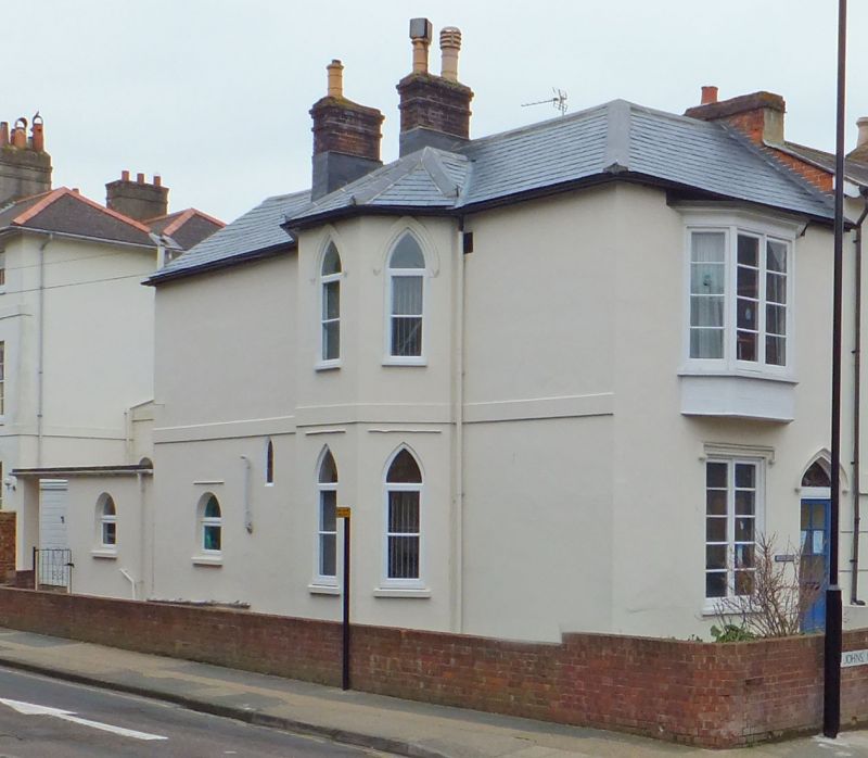
ST JOHN'S PLACE
1.
1445
SZ 4988 NE 6/90 No 1
II GV
2.
Early C19 2 storeys stucco. Low pitch gable end slate roof. Bay window
1st floor of 4 lights, casements. Ground floor window recessed, sash,
block sill, Gothic label over. Recessed panelled door also with Gothic
label.
Nos 1 to 8(consec) form a group
Listing NGR: SZ4985988754
External links are from the relevant listing authority and, where applicable, Wikidata. Wikidata IDs may be related buildings as well as this specific building. If you want to add or update a link, you will need to do so by editing the Wikidata entry.


Other nearby listed buildings
