Approximate Location Map
Large Map »
Latitude: 51.4222 / 51°25'20"N
Longitude: -1.7272 / 1°43'37"W
OS Eastings: 419063
OS Northings: 169282
OS Grid: SU190692
Mapcode National: GBR 4X2.VHH
Mapcode Global: VHC1P.0JR2
Plus Code: 9C3WC7CF+V4
Entry Name: 11, the Green
Listing Date: 21 October 1974
Grade: II
Source: Historic England
Source ID: 1253055
English Heritage Legacy ID: 310296
ID on this website: 101253055
Location: Marlborough, Wiltshire, SN8
County: Wiltshire
Civil Parish: Marlborough
Built-Up Area: Marlborough
Traditional County: Wiltshire
Lieutenancy Area (Ceremonial County): Wiltshire
Tagged with: Building
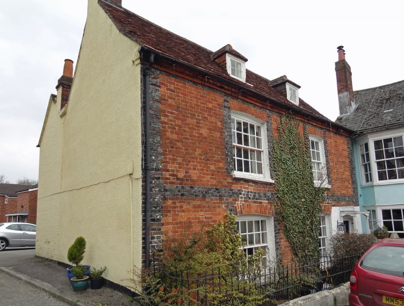
THE GREEN
1.
5407
(East Side)
No 11
SU 1969 1/77
II GV
2.
C18. 2 storey and attic. Red brick with vitreous quoins and window surrounds.
Old tile roof. 2 hipped dormers. 2 windows, 4 panes wide on lefthand and door
at righthand in lattice porch.
Nos 8 to 16 (consec) form a group.
Listing NGR: SU1906469277
External links are from the relevant listing authority and, where applicable, Wikidata. Wikidata IDs may be related buildings as well as this specific building. If you want to add or update a link, you will need to do so by editing the Wikidata entry.


Other nearby listed buildings
