Approximate Location Map
Large Map »
Latitude: 51.4221 / 51°25'19"N
Longitude: -1.7272 / 1°43'38"W
OS Eastings: 419061
OS Northings: 169270
OS Grid: SU190692
Mapcode National: GBR 4X2.VHJ
Mapcode Global: VHC1P.0JQ4
Plus Code: 9C3WC7CF+V4
Entry Name: 12, the Green
Listing Date: 21 October 1974
Grade: II
Source: Historic England
Source ID: 1365404
English Heritage Legacy ID: 310297
ID on this website: 101365404
Location: Marlborough, Wiltshire, SN8
County: Wiltshire
Civil Parish: Marlborough
Built-Up Area: Marlborough
Traditional County: Wiltshire
Lieutenancy Area (Ceremonial County): Wiltshire
Tagged with: Building
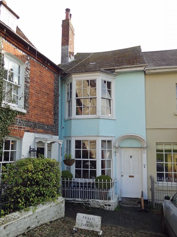
THE GREEN
1.
5407
(South Side)
No 12
SU 1969 1/162
II GV
2.
C18. 2 storey. Stucco. Slate roof. 2 storey angular bay window with door at
right hand under 3 centred arched hood.
Nos 8 to l6 (consec) form a group.
Listing NGR: SU1906369267
External links are from the relevant listing authority and, where applicable, Wikidata. Wikidata IDs may be related buildings as well as this specific building. If you want to add or update a link, you will need to do so by editing the Wikidata entry.


Other nearby listed buildings
