Approximate Location Map
Large Map »
Latitude: 51.4199 / 51°25'11"N
Longitude: -1.7318 / 1°43'54"W
OS Eastings: 418745
OS Northings: 169017
OS Grid: SU187690
Mapcode National: GBR 4X2.T4Q
Mapcode Global: VHB46.XKTW
Plus Code: 9C3WC799+W7
Entry Name: 26 and 27, High Street
Listing Date: 18 July 1949
Last Amended: 21 October 1974
Grade: II
Source: Historic England
Source ID: 1034249
English Heritage Legacy ID: 310329
ID on this website: 101034249
Location: Marlborough, Wiltshire, SN8
County: Wiltshire
Civil Parish: Marlborough
Built-Up Area: Marlborough
Traditional County: Wiltshire
Lieutenancy Area (Ceremonial County): Wiltshire
Tagged with: Building
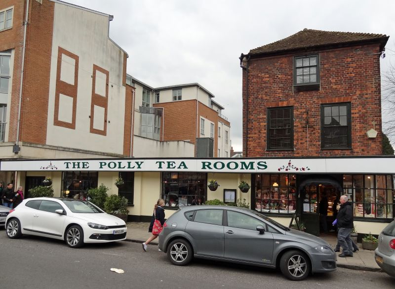
HIGH STREET
1.
5407
(South Side)
Nos 26 and 27
(Formerly listed as
Nos 26, 27 & 27a)
SU 1869 1/11 18.7.49.
II.
2.
C18. No 26 burned out and recently dismantled apart from ground floor, which
is stucco and has 3 bowed windows with glazing bars. No 27 red brick, with hipped
old tile roof, and 1 window on 2nd floor, 2 windows on lst floor, and late C18
bow shop window, extending round corner as part of 2 sides of house.
Listing NGR: SU1875269009
External links are from the relevant listing authority and, where applicable, Wikidata. Wikidata IDs may be related buildings as well as this specific building. If you want to add or update a link, you will need to do so by editing the Wikidata entry.


Other nearby listed buildings
