Approximate Location Map
Large Map »
Latitude: 51.4193 / 51°25'9"N
Longitude: -1.7324 / 1°43'56"W
OS Eastings: 418701
OS Northings: 168959
OS Grid: SU187689
Mapcode National: GBR 4X2.SZP
Mapcode Global: VHB46.XLH9
Plus Code: 9C3WC799+P2
Entry Name: 35, High Street
Listing Date: 21 October 1974
Grade: II
Source: Historic England
Source ID: 1034252
English Heritage Legacy ID: 310334
ID on this website: 101034252
Location: Marlborough, Wiltshire, SN8
County: Wiltshire
Civil Parish: Marlborough
Built-Up Area: Marlborough
Traditional County: Wiltshire
Lieutenancy Area (Ceremonial County): Wiltshire
Tagged with: Building
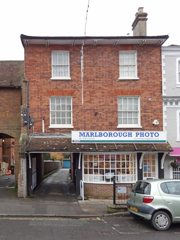
HIGH STREET STREET
1.
5407
(South Side)
No 35
SU 1868 2/15
II GV
2.
Early C19. 3 storey. Red brick. Boxed eaves with pairs of widely spaced brackets,
slate roof. 2 windows on upper floors, 4 panes wide on 1st floor.
Nos 30 to 38 (consec) form a group.
Listing NGR: SU1870168959
External links are from the relevant listing authority and, where applicable, Wikidata. Wikidata IDs may be related buildings as well as this specific building. If you want to add or update a link, you will need to do so by editing the Wikidata entry.


Other nearby listed buildings
