Approximate Location Map
Large Map »
Latitude: 51.4208 / 51°25'14"N
Longitude: -1.7261 / 1°43'33"W
OS Eastings: 419143
OS Northings: 169124
OS Grid: SU191691
Mapcode National: GBR 4X2.VV9
Mapcode Global: VHC1P.1KB5
Plus Code: 9C3WC7CF+8H
Entry Name: 11, London Road
Listing Date: 21 October 1974
Grade: II
Source: Historic England
Source ID: 1034206
English Heritage Legacy ID: 310426
ID on this website: 101034206
Location: Marlborough, Wiltshire, SN8
County: Wiltshire
Civil Parish: Marlborough
Built-Up Area: Marlborough
Traditional County: Wiltshire
Lieutenancy Area (Ceremonial County): Wiltshire
Tagged with: Building
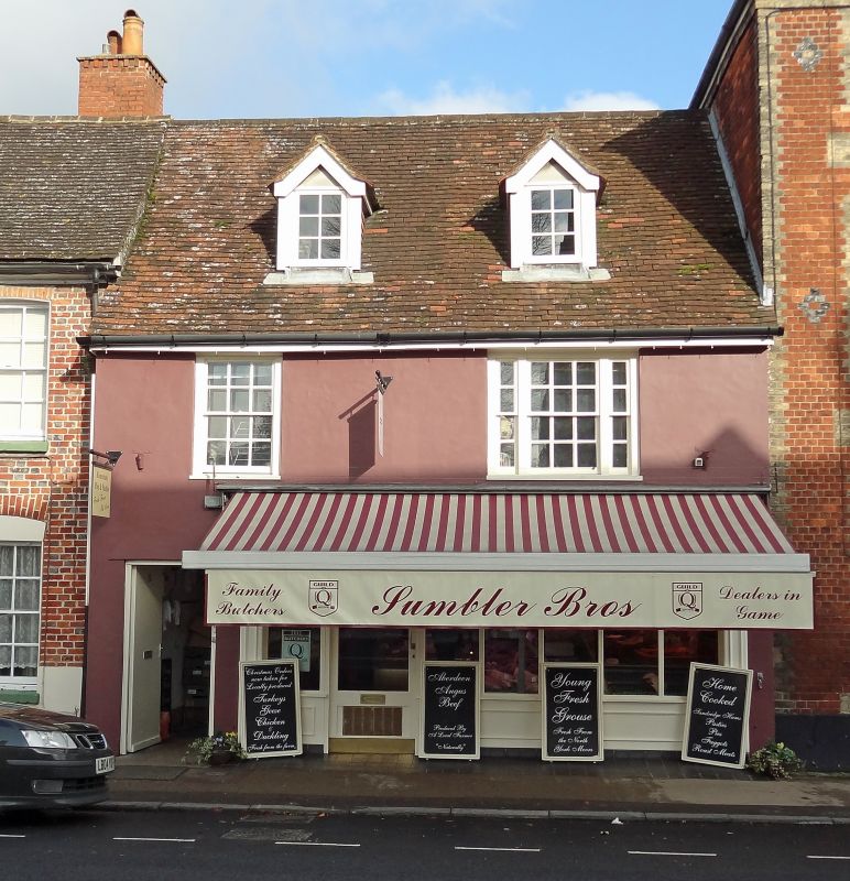
LONDON ROAD
1.
5407
(East Side)
No 11
SU 1969 1/226
II GV
2.
C18 Rendered Pitched tile roof. Rendered stack. 2 storeys and attic. Ground
floor entirely rebuilt in mid-C20. 2 flush-framed cased sashes with glazing bars
(right hand tripartite) on 1st floor. 2 attic dormers with pitched roofs, tile-hung
checks and casements.
Nos 9 to 12 (consec) The Five Alls public house, stables and coach house and
Nos 14 to 23 (consec) form a group.
Listing NGR: SU1914369124
External links are from the relevant listing authority and, where applicable, Wikidata. Wikidata IDs may be related buildings as well as this specific building. If you want to add or update a link, you will need to do so by editing the Wikidata entry.


Other nearby listed buildings
