Approximate Location Map
Large Map »
Latitude: 51.4204 / 51°25'13"N
Longitude: -1.7255 / 1°43'31"W
OS Eastings: 419182
OS Northings: 169082
OS Grid: SU191690
Mapcode National: GBR 4X2.W0M
Mapcode Global: VHC1P.1KNG
Plus Code: 9C3WC7CF+5Q
Entry Name: 14-23, London Road
Listing Date: 21 October 1974
Grade: II
Source: Historic England
Source ID: 1034209
English Heritage Legacy ID: 310430
ID on this website: 101034209
Location: Marlborough, Wiltshire, SN8
County: Wiltshire
Civil Parish: Marlborough
Built-Up Area: Marlborough
Traditional County: Wiltshire
Lieutenancy Area (Ceremonial County): Wiltshire
Tagged with: Building
LONDON ROAD
1.
5407
(East Side)
Nos 14 to 23 (consec)
SU 1969 1/105
II GV
2.
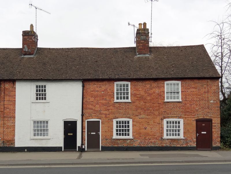
C18. 2 storey. Colourwashed brick. Old tile roof. Terrace of small cottages each
with one window and one door. The right hand half of terrace has original windows,
4 panes wide. The left hand half has mostly C19 sashes.
Nos 9 to 12 (consec) The Five Alls public house, stables and coach house and
Nos 14 to 23 (consec) form group.
Listing NGR: SU1918269082
External links are from the relevant listing authority and, where applicable, Wikidata. Wikidata IDs may be related buildings as well as this specific building. If you want to add or update a link, you will need to do so by editing the Wikidata entry.


Other nearby listed buildings
