Approximate Location Map
Large Map »
Latitude: 51.4784 / 51°28'42"N
Longitude: -1.621 / 1°37'15"W
OS Eastings: 426413
OS Northings: 175566
OS Grid: SU264755
Mapcode National: GBR 5XY.BYY
Mapcode Global: VHC1J.V3CG
Plus Code: 9C3WF9HH+9H
Entry Name: 3 and 5 Castle Street
Listing Date: 22 August 1966
Grade: II
Source: Historic England
Source ID: 1034182
English Heritage Legacy ID: 310473
ID on this website: 101034182
Location: Aldbourne, Wiltshire, SN8
County: Wiltshire
Civil Parish: Aldbourne
Built-Up Area: Aldbourne
Traditional County: Wiltshire
Lieutenancy Area (Ceremonial County): Wiltshire
Tagged with: Building
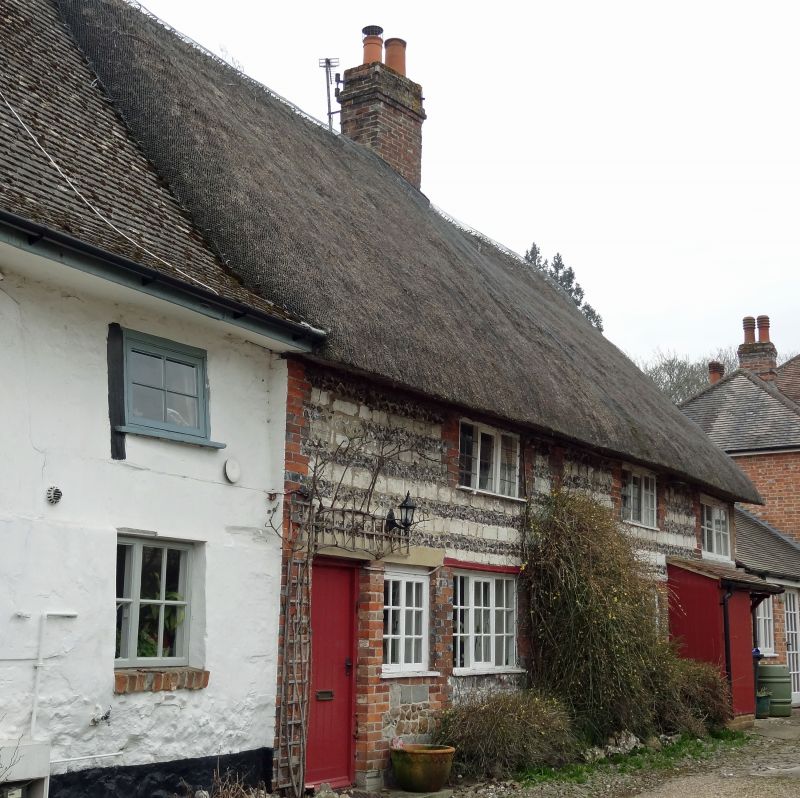
ALDBOURNE CASTLE STREET (south side)
SU 27 NE 9/13
22.8.66
Nos 3 and 5
GV II
Pair of cottages, now 1 house. C18. Sarsen plinth, banded chalkstone and flint above with brick dressings. 2-storey, each cottage 1 narrow and 1 wide bay. Boarded doors, 2- and 3-light timber casements with some glazing bars and leaded lights. Central 4-flue stack. Interior: Haunched posts with angle braces to tie, possibly originally a barn to No. 1. Slightly chamfered spine beams.
Listing NGR: SU2641375566
External links are from the relevant listing authority and, where applicable, Wikidata. Wikidata IDs may be related buildings as well as this specific building. If you want to add or update a link, you will need to do so by editing the Wikidata entry.


Other nearby listed buildings
