Approximate Location Map
Large Map »
Latitude: 51.4821 / 51°28'55"N
Longitude: -1.6185 / 1°37'6"W
OS Eastings: 426585
OS Northings: 175979
OS Grid: SU265759
Mapcode National: GBR 5XY.5LR
Mapcode Global: VHC1J.W0PM
Plus Code: 9C3WF9JJ+VH
Entry Name: Foundry Cottage
Listing Date: 6 March 1985
Grade: II
Source: Historic England
Source ID: 1034156
English Heritage Legacy ID: 310510
ID on this website: 101034156
Location: Aldbourne, Wiltshire, SN8
County: Wiltshire
Civil Parish: Aldbourne
Built-Up Area: Aldbourne
Traditional County: Wiltshire
Lieutenancy Area (Ceremonial County): Wiltshire
Tagged with: Cottage
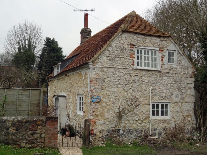
ALDBOURNE LOTTAGE ROAD (west side)
SU 27 NE 9/50
No 39 (Foundry Cottage)
II
Cottage, late C17, whitewashed sarsen rubble, tiled roof. 1-storey and attic, 2 bays, placed gable to street. Timber casement windows and horizontal sliding sashes. Door between bays in simple boarded porch. Brick dentilled eaves. Roof half hipped right and gable stack left, and with 1 dormer. Rear lean-tos.
Listing NGR: SU2658575979
External links are from the relevant listing authority and, where applicable, Wikidata. Wikidata IDs may be related buildings as well as this specific building. If you want to add or update a link, you will need to do so by editing the Wikidata entry.


Other nearby listed buildings
