Approximate Location Map
Large Map »
Latitude: 51.4957 / 51°29'44"N
Longitude: -1.6529 / 1°39'10"W
OS Eastings: 424193
OS Northings: 177478
OS Grid: SU241774
Mapcode National: GBR 5XQ.2YG
Mapcode Global: VHC1B.9NJQ
Plus Code: 9C3WF8WW+7R
Entry Name: Milestone on Aldbourne to Swindon Road. South of Aldbourne Warren Farm
Listing Date: 6 March 1985
Grade: II
Source: Historic England
Source ID: 1034169
English Heritage Legacy ID: 310541
ID on this website: 101034169
Location: Wiltshire, SN8
County: Wiltshire
Civil Parish: Aldbourne
Traditional County: Wiltshire
Lieutenancy Area (Ceremonial County): Wiltshire
Tagged with: Milestone
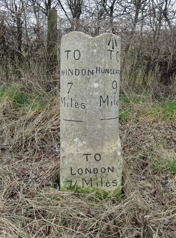
SU 27 NW ALDBOURNE SWINDON ROAD
1/82 Milestone on Aldbourne to
Swindon Road. South of
Aldbourne Warren Farm.
II
Milestone, at SU 242775 early C19. Limestone half-oval shaft with grooved top.
Legend obscured by repainting, now reading SWINDON 7, HUNGERFORD
9.
Listing NGR: SU2419377478
External links are from the relevant listing authority and, where applicable, Wikidata. Wikidata IDs may be related buildings as well as this specific building. If you want to add or update a link, you will need to do so by editing the Wikidata entry.


Other nearby listed buildings
