Approximate Location Map
Large Map »
Latitude: 51.4974 / 51°29'50"N
Longitude: -1.7013 / 1°42'4"W
OS Eastings: 420832
OS Northings: 177644
OS Grid: SU208776
Mapcode National: GBR 4WB.2P7
Mapcode Global: VHC19.GMGH
Plus Code: 9C3WF7WX+WF
Entry Name: Lower Upham Farm
Listing Date: 6 March 1985
Grade: II
Source: Historic England
Source ID: 1034128
English Heritage Legacy ID: 310545
ID on this website: 101034128
Location: Lower Upham, Wiltshire, SN8
County: Wiltshire
Civil Parish: Aldbourne
Traditional County: Wiltshire
Lieutenancy Area (Ceremonial County): Wiltshire
Tagged with: Building
SU 27 NW ALDBOURNE UPHAM
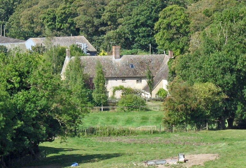
1/86 Lower Upham Farm
II
Farmhouse. Early C19 on site of C18 house. Stucco with tiled roof.
2-storey, 6 x 1 bays with 2 bay rear extension to left. Entrances
in 2nd bay, 6 reeded panels with simple bracketed canopy, and in
4th bay, within C20 gabled porch. 16-pane sashes. Casements and
other windows to rear. Roof hipped left, stack opposite entrance
in 4th bay, and gable stack to left.
Interior not seen.
Listing NGR: SU2083277644
External links are from the relevant listing authority and, where applicable, Wikidata. Wikidata IDs may be related buildings as well as this specific building. If you want to add or update a link, you will need to do so by editing the Wikidata entry.


Other nearby listed buildings
