Approximate Location Map
Large Map »
Latitude: 51.4792 / 51°28'45"N
Longitude: -1.623 / 1°37'22"W
OS Eastings: 426277
OS Northings: 175647
OS Grid: SU262756
Mapcode National: GBR 5XY.BGB
Mapcode Global: VHC1J.T2BW
Plus Code: 9C3WF9HG+MR
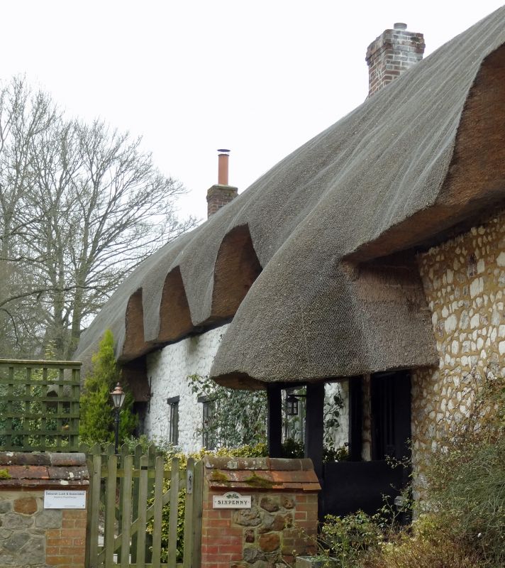
Entry Name: Sixpenny
Listing Date: 6 March 1985
Grade: II
Source: Historic England
Source ID: 1365452
English Heritage Legacy ID: 310547
ID on this website: 101365452
Location: Aldbourne, Wiltshire, SN8
County: Wiltshire
Civil Parish: Aldbourne
Built-Up Area: Aldbourne
Traditional County: Wiltshire
Lieutenancy Area (Ceremonial County): Wiltshire
Tagged with: Building
ALDBOURNE WEST STREET (south side)
SU 27 NE 9/88
Nos 27 - 29. (consecutive) (Sixpenny).
GV II
4 cottages now house. C17-C18, colourwashed chalkstone and sarsen, thatched roof. Entrances originally to west, now 2 thatched porches on east. Each cottage of 1 bay and passage, the block divided from No 33 (q.v.) by open through passage, now incorporated in house. Thatch swept over 4 flush dormers.
Listing NGR: SU2627775647
External links are from the relevant listing authority and, where applicable, Wikidata. Wikidata IDs may be related buildings as well as this specific building. If you want to add or update a link, you will need to do so by editing the Wikidata entry.


Other nearby listed buildings
