Approximate Location Map
Large Map »
Latitude: 51.48 / 51°28'48"N
Longitude: -1.6245 / 1°37'28"W
OS Eastings: 426170
OS Northings: 175742
OS Grid: SU261757
Mapcode National: GBR 5XY.432
Mapcode Global: VHC1J.S2J7
Plus Code: 9C3WF9JG+25
Entry Name: Granary West of Drive Access to Nos 22-26
Listing Date: 6 March 1985
Grade: II
Source: Historic England
Source ID: 1200532
English Heritage Legacy ID: 310559
ID on this website: 101200532
Location: Aldbourne, Wiltshire, SN8
County: Wiltshire
Civil Parish: Aldbourne
Built-Up Area: Aldbourne
Traditional County: Wiltshire
Lieutenancy Area (Ceremonial County): Wiltshire
Tagged with: Granary
ALDBOURNE WEST STREET (north side)
SU 27 NE 9/100
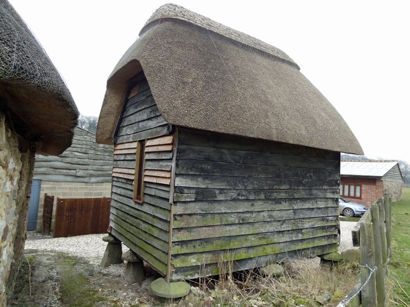
Granary west of drive access to Nos 22 - 26.
II
Granary. C18. Timber framed with weatherboarding on staddles. Half hipped thatched roof. Rectangular, 2 x 2 bays. Central passage with bins either side with raking partitions. Loft over.
Listing NGR: SU2617075742
External links are from the relevant listing authority and, where applicable, Wikidata. Wikidata IDs may be related buildings as well as this specific building. If you want to add or update a link, you will need to do so by editing the Wikidata entry.


Other nearby listed buildings
